
Stand on a beach and look out at the water. It looks flat and calm. It looks knowable. Then you learn that the seafloor beneath it hides mountain ranges taller than the Alps. It hides trenches deep enough to swallow Mount Everest with room to spare. The ocean suddenly feels like a different planet. That gap between what we see and what actually sits below is exactly why ocean depth measurement has become one of the busiest fields in modern marine science.
Robert Ballard Discoveries The Man Who Found the Titanic
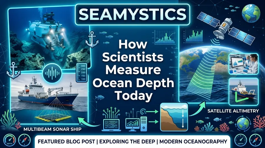
For most of human history, sailors measured depth with a rope and a rock. Today, research vessels bounce sound off the seafloor. Satellites read the shape of the sea surface from space. Robotic vehicles crawl across the bottom and collect data no ship could ever reach. Yet as of April 2026, teams have mapped only 28.7% of the global ocean floor to modern standards, according to the Nippon Foundation-GEBCO Seabed 2030 Project. We know less about our own ocean floor than we know about the surface of Mars.
This guide walks through how scientists measure ocean depth today. It covers why the work matters far beyond curiosity. It also covers what still stands between us and a complete picture of the seafloor.
Key Takeaways
| Topic | What You Need to Know |
|---|---|
| Main tool | Sonar, specifically multibeam echo sounders, remains the primary method for ocean depth measurement |
| Satellite role | Satellite altimetry estimates depth indirectly by reading tiny bumps and dips in sea surface height |
| Average depth | The global ocean averages roughly 3,682 to 3,700 meters (about 12,080 feet) deep |
| Deepest point | Challenger Deep in the Mariana Trench reaches close to 10,935 to 11,034 meters, depending on the survey |
| Global progress | Teams had mapped 28.7% of the seafloor to modern standards as of April 2026, per Seabed 2030 |
| Newer tools | Autonomous underwater vehicles, uncrewed surface vessels, and AI-assisted data processing now speed up mapping |
| Deadline | The Seabed 2030 initiative aims for a complete, high-resolution map of the ocean floor by 2030 |
TL;DR: Scientists measure ocean depth mainly with sonar. Ships and robotic vehicles send sound pulses that bounce off the seafloor and return, and satellite altimetry fills in the broad ocean basins in between. Roughly 71% of the seafloor still lacks a modern survey, so projects like Seabed 2030 are racing to close the gap with ships, drones, and shared data before the decade ends.
Why Ocean Depth Measurement Still Matters in 2026
It would be easy to assume this problem got solved decades ago. It has not. Ocean depth measurement, also known as bathymetry, shapes tsunami warning models, submarine cable routes, and fisheries management. Gaps in the data carry real consequences.
HMS Challenger Expedition The Voyage That Founded Oceanography
Coastal cities rely on accurate seafloor maps to predict how a tsunami wave will behave near shore. Shipping companies use bathymetric charts to avoid running vessels aground on features nobody has surveyed. Climate scientists study seafloor depth changes to understand ocean heat storage and sea level rise. None of that work happens without a steady stream of new depth data.
Dr. Rabica, the marine biologist behind this piece, has spent field seasons aboard coastal survey vessels watching multibeam sonar screens paint the seafloor in real time. One lesson stands out above the rest. The ocean does not give up its shape easily, and every meter of new data usually costs real ship time, real fuel, and real patience.
How Ocean Depth Measured Today: The Core Methods
Modern ocean depth measurement uses a small toolkit of methods, and each method suits a different job. Some cover huge areas quickly but roughly. Others move slowly but capture fine detail. Most large mapping projects blend several of these together.
Sonar Depth Measurement: Still the Workhorse
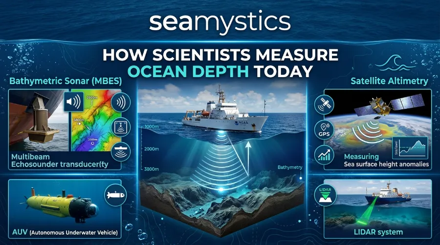
Sonar depth measurement remains the backbone of modern bathymetry, and for good reason. A ship, buoy, or underwater vehicle sends a pulse of sound toward the seafloor. The sound bounces back, and the system calculates depth from the travel time and the known speed of sound in seawater.
There are two main types in active use:
- Single-beam echo sounders send one sound pulse straight down and produce a single depth reading along the ship’s track. They stay simple and affordable, and smaller research and fishing vessels still use them.
- Multibeam echo sounders fire dozens or hundreds of sound pulses in a fan pattern beneath the hull. Each pass builds a wide swath of depth data. Nearly every high-resolution seafloor map since the 1990s relies on this method.
A single multibeam pass can map a strip of seafloor several times wider than the water is deep. That is why survey ships chart thousands of square kilometers on one transit. This kind of precision is not new either. As far back as 1963, researchers built a bottom-mounted narrow-beam sonar that measured ocean wave height with roughly 1 centimeter of resolution at depths between 6 and 67 meters. It was an early sign of how precise acoustic methods could become. For readers who want the physics behind how sound behaves underwater, our guide on ocean pressure explains how depth changes the water column sound travels through.
Satellite Altimetry: Mapping the Ocean From Space
Here is something that surprises most people. Satellites cannot see through water, yet they still help measure ocean depth. Satellite altimetry measures the height of the sea surface itself, down to a few centimeters of precision, using radar.
Large seafloor features like underwater mountains and trenches pull on the water above them with extra gravity. That pull creates tiny bumps and dips on the ocean surface, and satellites can detect them. Scientists then convert those surface variations into estimated depth values across entire ocean basins. This method gave the deep, remote ocean its first depth estimates long before ships could reach it, and it still fills the gaps between ship tracks today.
Lidar and Airborne Bathymetry
In shallow coastal water, aircraft carry laser systems called lidar to measure depth from above. The system times how long green laser light takes to reach the bottom and bounce back. This method works well down to roughly 50 meters in clear water, so it suits coastline mapping, hazard surveys, and beach erosion studies where ships cannot easily reach.
Autonomous and Uncrewed Vehicles
The newest wave of bathymetry technology facts involves machines that need no crew at all. Autonomous underwater vehicles (AUVs) and uncrewed surface vessels now carry sonar systems into areas too dangerous, too remote, or too costly for traditional research ships. In 2024, the Schmidt Ocean Institute’s research vessel Falkor (too) used multibeam mapping to find four uncharted underwater mountains during a single transit between Costa Rica and Chile. The tallest stood more than 1.5 miles high, and no bathymetric database had recorded any of them before that survey. Our piece on thermohaline ocean circulation covers how newly mapped seafloor features shape deep ocean currents.
Measuring the Ocean Floor: A Short History
Understanding today’s methods helps to know where they came from. The story of measuring the ocean floor stretches back thousands of years, long before anyone dreamed of sound waves or satellites.
- Ancient sounding lines. The earliest recorded water depth measurements date back over 3,000 years to Ancient Egypt, where sailors lowered weighted ropes to check depth before entering harbors.
- The HMS Challenger expedition (1872 to 1876). This British Royal Navy voyage carried 291 kilometers of rope to measure ocean depth point by point. Its crew documented one of the deepest zones on Earth in the western Pacific, a trench later named the Mariana Trench.
- Mechanical echo sounders (1920s onward). Sound-based sounding replaced rope lines for deepwater surveys and produced continuous graphic depth records instead of single point readings.
- Multibeam sonar (1990s onward). Wide-swath sonar systems turned depth measurement from a line of dots into a continuous, detailed picture of the seafloor.
- Satellite altimetry and AI-assisted mapping (2000s to today). Space-based sensors and machine learning models now extend coverage into the most remote parts of the ocean.
Before echo sounding existed, the process moved at a crawl. Sailors lowered a weighted rope over the side and measured how much line it took to touch bottom. Currents often pulled the rope off course and produced a false reading. By the late 19th century, piano wire replaced rope on survey ships, and crews could sound depths of thousands of fathoms instead of a few hundred. It marked a real leap forward, even though it still measured one point at a time.
Bathymetry Technology Facts Worth Knowing
A few numbers put the scale of this work into perspective, and they explain why full ocean mapping has taken so long.
| Fact | Figure |
|---|---|
| Average ocean depth | Approximately 3,682 to 3,700 meters (12,080 to 12,140 feet) |
| Deepest known point | Challenger Deep, Mariana Trench, roughly 10,935 to 11,034 meters |
| Percentage of seafloor mapped (April 2026) | 28.7%, according to Seabed 2030 |
| New seafloor data added in the past year | Almost 5 million square kilometers |
| Total area currently mapped | Roughly 104 million square kilometers, more than two-thirds of Earth’s land surface |
| Countries and organizations contributing data | 220 organizations, including 15 new contributors in the past year |
| Target completion year | 2030 |
Progress has clearly picked up speed. The mapped share of the seafloor moved from 26.1% in mid-2024 to 27.3% in mid-2025, then to 28.7% by April 2026. That pace reflects growing use of AI-assisted data processing, shared ship data, and cheaper autonomous survey platforms. Even so, roughly 71% of the ocean floor still lacks a modern, high-resolution survey. Most of Earth’s largest geological features remain effectively unmapped in fine detail.
Real Examples: What New Depth Data Has Revealed
Numbers only tell part of the story, so it helps to look at what better ocean depth measurement has actually uncovered in recent years.
In 2024, survey teams mapped new seafloor off the southeastern United States and found an extensive coral habitat spanning more than 6.4 million acres on the Blake Plateau. Multiple agencies worked together to systematically map and characterize that stretch of seabed, and the discovery only became possible because of that joint effort. That same year, the Falkor (too) transit between Costa Rica and Chile uncovered four uncharted underwater mountains. The find showed how much remains hidden even along routine shipping and research corridors.
Closer to shore, the United States Geological Survey compared sonar-measured bathymetry against camera-based depth estimates near Madeira Beach, Florida. The two methods matched closely: a sandbar sat roughly 140 meters from shore, a trough sat near 100 meters, and the water shallowed near the 50-meter mark. Survey teams collected the two datasets five months apart, yet the results still lined up. That kind of cross-checking is exactly how teams build confidence in new depth measurement techniques before they scale them up.
FAQ: Common Questions About Ocean Depth Measurement
How is ocean depth measured most accurately today? Multibeam sonar mounted on survey ships or autonomous vehicles gives the most accurate readings for detailed seafloor mapping. It directly measures sound travel time across a wide swath of the bottom instead of estimating depth indirectly.
What is the deepest part of the ocean, and how deep is it? The Challenger Deep sits in the Mariana Trench in the western Pacific and marks the deepest known point in the ocean. Survey estimates place it between roughly 10,935 and 11,034 meters below the surface.
Why has so little of the ocean floor been mapped? Ship-based surveys move slowly, cost a lot, and depend on weather, fuel, and crew availability. The ocean is also simply enormous, since it covers more than 70% of Earth’s surface. Even with satellites and autonomous vehicles helping, high-resolution coverage still takes years to expand.
Can satellites measure ocean depth directly? Not directly. Satellites measure tiny variations in sea surface height caused by the gravity of large underwater features. Scientists then convert those variations into estimated depth, and this technique fills gaps between ship-based surveys rather than replacing them.
What is Seabed 2030? Seabed 2030 is an international collaboration between the Nippon Foundation and GEBCO. The project aims to produce a complete, publicly available map of the world’s ocean floor by 2030, and more than 220 organizations worldwide now contribute ship, vehicle, and satellite data to it.
Where This Is Headed
The next few years will likely bring faster progress than the previous decade, mostly because the tools keep getting cheaper and smarter. Uncrewed survey vessels can now stay at sea for weeks without a crew. AI models process raw sonar data faster than human analysts can. More merchant and cruise ships now share depth data collected during ordinary transits instead of dedicated survey trips.
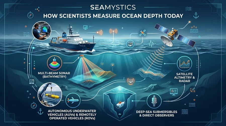
None of that changes the basic physics involved, though. Sound still travels through water at a fixed and predictable speed. Depth still depends on measuring that travel time as precisely as possible, whether the sensor sits on a ship, a drone, or a satellite hundreds of kilometers overhead. Readers curious about how sound and light behave differently underwater might enjoy our related piece on underwater light science, which covers why sonar succeeds where cameras usually fail in deep water.
Conclusion
Ocean depth measurement has come a long way from a sailor tossing a weighted rope over the side of a wooden ship. The underlying goal has not changed at all: figure out how far down the bottom actually sits. Sonar, satellite altimetry, lidar, and autonomous vehicles now work together to answer that question faster and more precisely than any earlier generation could manage. Even so, teams have mapped less than a third of the seafloor to modern standards. This remains one of the last great mapping projects left on our own planet, and the next decade of survey work will likely reveal features nobody has ever seen before.
References
- The Nippon Foundation-GEBCO Seabed 2030 Project, “Global seabed mapping reaches new milestone,” April 2026, seabed2030.org
- Encyclopaedia Britannica, “Bathymetry,” britannica.com/science/bathymetry
- NIST, “How Do You Measure the Depth of the Ocean?”, nist.gov
- United States Geological Survey, “Estimated and Measured Ocean Depths, Madeira Beach,” usgs.gov
- European Marine Observation and Data Network (EMODnet), “Map of the Week: Mean Underwater Depth,” emodnet.ec.europa.eu
- Center for Coastal and Ocean Mapping, University of New Hampshire, “Bathymetric Globe,” ccom.unh.edu
- OpenSeaMap, interactive nautical charting project, map.openseamap.org
- Ecomagazine, “Seabed 2030 Project Issues Update on Global Mapping Coverage,” April 2026