
A wooden ship sank off the coast of Antikythera more than two thousand years ago. It took modern divers until 2024 to finally lift a piece of its hull, still holding its original wooden pegs. That single fact tells you almost everything about underwater archaeology methods. This work demands patience, pressure, and a lot of careful hands working in the dark. It sits at the crossing point of history and diving, and it answers a question that has nagged coastal communities forever: what happens to the past when it sinks.
Lighthouse Navigation History: How Beacons Guided Sailors for 2,300 Years
TL;DR: Underwater archaeology methods combine sonar mapping, diver-led excavation, and remotely operated vehicles to locate, document, and recover sunken ships and settlements. Experts follow strict conservation rules once an artifact leaves the seabed, because air exposure can ruin in minutes what survived underwater for centuries. Recent digs, from Antikythera to a 16th-century vessel found off France in 2025, show the field is more active right now than at almost any point in its history.
Key Takeaways
| Focus Area | What It Covers | Why It Matters |
|---|---|---|
| Detection | Sonar, magnetometry, sub-bottom profiling | Finds wrecks buried under sediment before a diver gets wet |
| Excavation | Airlifts, dredges, grid-based digging | Removes sediment layer by layer without damaging fragile timber |
| Robotics | ROVs and AUVs | Reaches depths past 300 feet where divers cannot safely work |
| Conservation | Desalination, controlled drying, freeze-drying | Stops centuries-old wood and metal from crumbling in open air |
| Law and ethics | UNESCO 2001 Convention | Sets the standard for who may touch a wreck, and how |
What Underwater Archaeology Actually Is
Underwater archaeology studies human history preserved beneath oceans, lakes, and rivers. It shares its core logic with archaeology on land. Researchers still map a site. They still record every layer. They still ask what an object reveals about the people who used it.
The workspace makes the real difference. Current, cold, and darkness turn a routine measurement into a genuine physical challenge. Underwater archaeologists study fish weirs, sunken wharves, and shipwrecks using the same principles as land archaeology, only in a far tougher environment.
The Beagle Voyage Darwin Took How Five Years at Sea Rewrote Ocean Science
For the full backstory on how this discipline started, our guide on the history of underwater photography is a natural next stop. Photography and archaeology grew up together underwater. Anyone curious about how divers first gained the freedom to work at depth should also read our piece on the invention of the aqua-lung, since that single piece of gear made underwater archaeology possible at all.
Cold War Oceanography The Secret Race to Map the Ocean Floor
The Core Underwater Archaeology Methods Used Today
Fieldwork rarely starts with a diver jumping in and hoping for the best. It starts on a boat. Instruments do the searching long before anyone gets wet.
Remote Sensing Comes First
Teams need to know where to dig before excavation begins. Remote sensing tools handle that job. Side-scan sonar bounces sound waves off the seabed to reveal anything unusual poking through the sediment. Magnetometers detect metal objects like anchors and cannons buried under mud. Sub-bottom profilers see through layers of silt much like an X-ray sees through skin.
How Sonar Was Invented and Changed Ocean Exploration
Remote sensing lets archaeologists survey large stretches of seafloor efficiently. It flags anomalies that deserve a closer look before anyone commits to a dive. If you want to see how sound-based detection grew into a full science of its own, our article on the invention of sonar covers that history in depth.
How Diving Bells Paved the Way for Modern Submarines
Diving and Excavation Systems
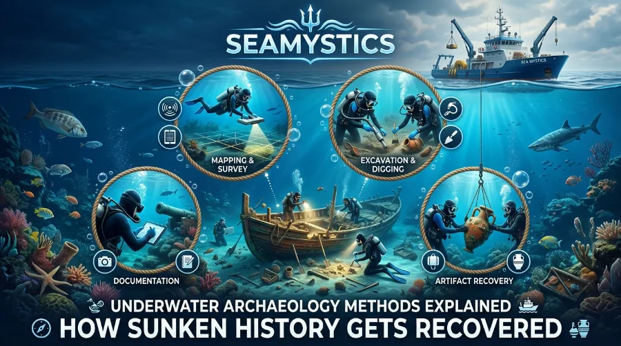
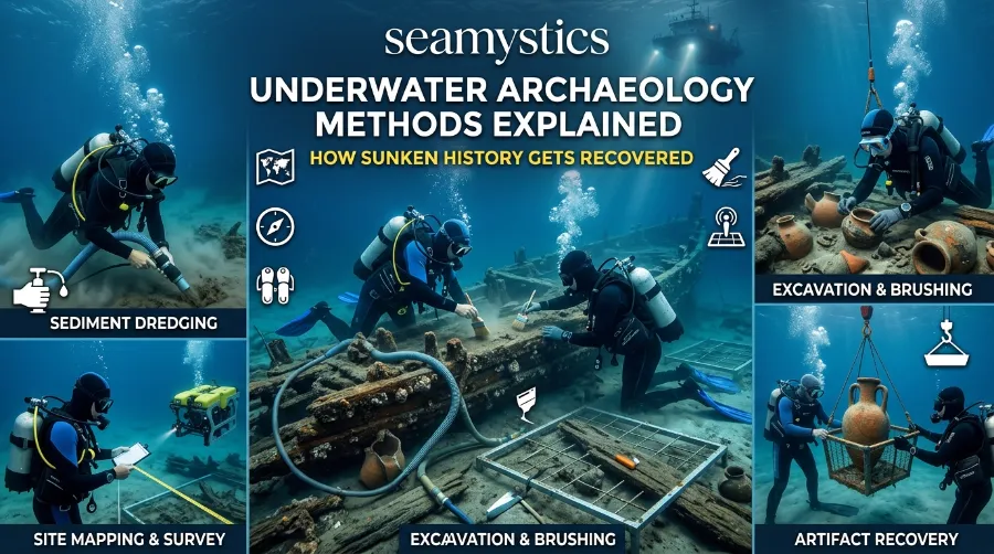
Once a site is confirmed, the physical work of shipwreck excavation methods begins. It looks nothing like digging on land. Divers use airlifts, which work like underwater vacuum cleaners, and dredges to pull sediment away from buried timber. Crews lay a grid over the site first, just like on land, so every fragment’s position gets recorded before it moves an inch.
Typical tools on a professional underwater excavation include:
- Airlifts and water dredges for clearing sediment without abrasive contact
- Underwater slates and waterproof cameras for on-site documentation
- Grid frames and baseline tapes for precise spatial recording
- Small hand tools, brushes, and probes for delicate artifact exposure
Dredging remains one of the most common shipwreck excavation methods. Crews can run it mechanically or by hand, and it clears overlying sediment gently enough to protect what lies beneath.
Robots Doing the Diving Humans Cannot
Not every wreck sits at diver-friendly depths. Remotely operated vehicles, or ROVs, now handle deep-water work that would be far too risky for a human diver. This is where the field overlaps with our coverage of deep-sea submersibles. A 2025 mapping expedition photographed the sunken carrier USS Yorktown using exactly this kind of robotic imaging. No diver had to descend to the wreck at all, and the resulting photogrammetric model gave researchers a full 3D record of the ship’s structure from a safe distance.
Marine Archaeology Techniques for Mapping and Recording
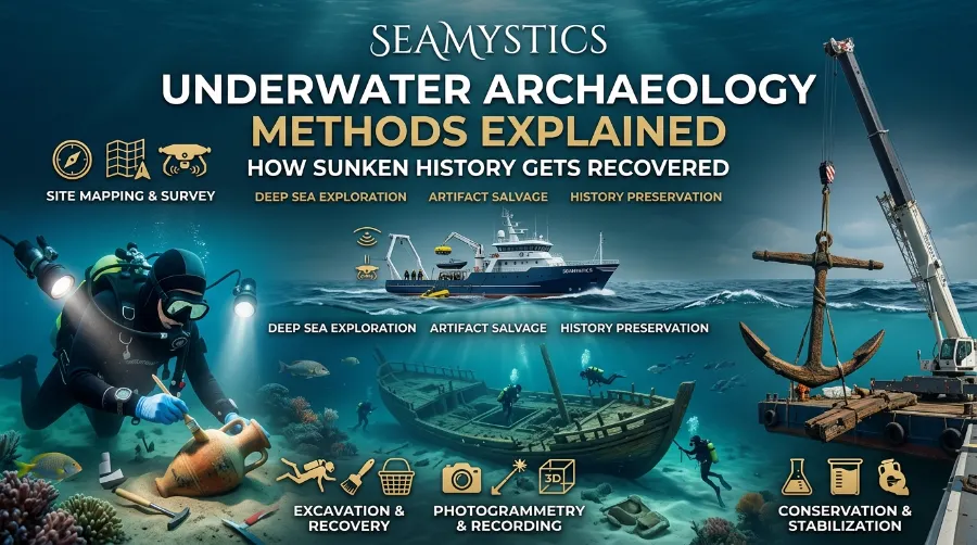
Locating a wreck is only step one. Recording it accurately matters just as much, so future researchers can study a site without ever getting wet themselves. Photogrammetry stitches together hundreds of overlapping photographs into a single 3D model. It has become the industry standard because it captures a site’s exact condition at one moment in time.
The University of Michigan’s underwater archaeology program documents this workflow in detail. Researchers there combine photographic surveys with hand measurement to cross-check accuracy on real excavation sites.
Recovered artifacts enter a second, quieter phase of science once they surface. Researchers run radiocarbon dating, X-ray fluorescence, and even DNA analysis on recovered material to pin down age and origin. A corroded lump of metal becomes a dated, documented artifact through this process. None of it happens quickly, and a single well-documented shipwreck excavation can run for years, sometimes decades, before researchers catalogue and conserve every piece.
Real Shipwrecks, Real Recoveries: Recent Case Studies
Numbers tell this story better than adjectives do. Here are dated, real examples from the last two years.
- Antikythera wreck, Greece, 2024 to 2025. Sponge divers first found this site in 1900, and it is still producing discoveries a century later. In 2024, researchers recovered a section of hull with its original wooden pegs and coating intact. In the 2025 season they pulled up planks measuring roughly 0.40 by 0.70 metres, made of elm and oak, and preliminarily dated them to around 235 BCE.
- Camarat 4, France, 2025. The French navy stumbled onto this 16th-century merchant vessel in March 2025 during a routine seabed survey. It sits over 2.5 kilometres down in the Mediterranean off the Ramatuelle coast near Saint-Tropez, making it the deepest known shipwreck in French waters.
- USS Stewart, California coast, October 2024. Researchers located this century-old destroyer using multibeam sonar imaging. It is a clean example of remote sensing solving a wartime mystery decades after the fact.
- Uluburun wreck, Turkey, excavated through the 1980s and 1990s. Its cargo of Mycenaean, Egyptian, and Cypriot goods rewrote what historians understood about Bronze Age trade. These ancient networks turned out to be far more connected than earlier land-based evidence had suggested.
Read more about the full detection-to-recovery pipeline in this detailed field methodology from the University of Michigan. This broader overview from DMET Club also covers how sunken cities and shipwrecks get discovered.
Nautical Archaeology History: From Sponge Divers to Sonar
Nautical archaeology history did not start with scientists. It started with sponge divers and salvage crews who stumbled onto wrecks while working. Nobody treated a shipwreck as a research site back then, only as a source of scrap metal.
Early twentieth-century surveys changed that slowly. Antoine Poidebard mapped the ancient port of Tyre in the 1930s using aerial photography combined with basic diving prospecting. It looks almost quaint next to today’s sonar arrays, but it was genuinely groundbreaking at the time.
The real turning point came once the field professionalised. The 2001 UNESCO Convention on the Protection of the Underwater Cultural Heritage requires a qualified underwater archaeologist with proven scientific competence to lead every recognised project. That sounds obvious today, but it was contested territory a century ago. This single rule ensures documentation and excavation techniques match professional standards, even under difficult conditions like extreme depth or low budgets, and it is the reason a modern excavation looks nothing like a treasure hunt.
If salvage history interests you, our deep dive into shipwreck salvage history traces how commercial recovery slowly gave way to scientific method. So much of this progress also tracked military technology. Our article on Cold War oceanography explains how naval sonar research quietly filtered down into civilian archaeological use.
Conservation, Preservation, and the Ethics of Recovery
Getting an artifact out of the water is the easy part, honestly. Keeping it from falling apart afterward takes the real skill. Waterlogged wood and iron reach a kind of chemical balance underwater. Pulling them into open air without treatment can crack, shrink, or rust that material apart within hours.
Standard conservation steps generally include:
- Slow, controlled desalination in freshwater tanks to remove absorbed salts
- Gradual drying, sometimes over months, to avoid warping wooden fibres
- Freeze-drying for particularly fragile organic material
- Chemical stabilisation for metal objects prone to corrosion once exposed to oxygen
Divers researching modern underwater work often turn to community resources like Shearwater’s guide on underwater excavation for a look at how recreational and technical diving gear now overlaps with archaeological fieldwork. Many research expeditions rely on the same dive computers and gas planning tools built for technical divers.
Ethics matter just as much as chemistry here. A wreck is frequently also a grave site. Reputable teams treat human remains with the same care land archaeologists apply, pausing recovery work and consulting relevant authorities before proceeding.
Underwater Archaeology Facts You Probably Didn’t Know
- Antikythera has been under active, funded excavation since 2021, and researchers still don’t know whether one ship sank there or two.
- Uluburun’s cargo represented at least seven ancient cultures, discovered in a wreck barely 15 metres deep off the Turkish coast.
- Camarat 4 sits deeper than most commercial submarines can safely reach, so its ongoing study will rely almost entirely on ROV imaging rather than diver access.
- Grid-based excavation on the seafloor uses the same numbering logic as a dry dig site, just anchored against current instead of gravity.
Frequently Asked Questions
What is the main method used in underwater archaeology?
There is no single method. Teams typically combine sonar-based detection, grid-based diver excavation, and photogrammetric recording. The mix depends on depth, visibility, and budget.
How deep can underwater archaeologists actually dive?
Trained technical divers can safely work to roughly 100 to 130 metres with specialised gas mixes. Anything beyond that generally shifts to ROVs, as with the 2.5 kilometre-deep Camarat 4 wreck.
Why does conservation take so long after a shipwreck is recovered?
Waterlogged material needs slow, controlled drying and desalination, sometimes over months or years. Rapid exposure to air causes irreversible cracking and shrinkage.
Is underwater archaeology the same as treasure hunting?
No, and the distinction matters legally as well as ethically. The 2001 UNESCO Convention separates commercial salvage from scientific archaeology. It requires qualified oversight and full documentation, not simple recovery for profit.
Conclusion
Every sunken ship tells two stories at once. One ended when the ship went down. The other starts the moment a research team finds it again. Underwater archaeology methods, from a sonar ping on a research vessel to a diver’s gloved hand brushing sediment off a 2,000-year-old plank, exist to tell that second story accurately. Antikythera keeps producing new hull sections. France found its deepest wreck yet in 2025. The ocean clearly still holds a lot more history to hand back to us.
References
- Antikythera shipwreck 2025 excavation findings, Swiss School of Archaeology in Greece / Archaeology News (archaeologymag.com)
- 2024 Antikythera hull discovery press release, University of Geneva (unige.ch)
- France’s deepest shipwreck, Camarat 4, off Ramatuelle, Archaeology News (archaeologymag.com)
- Underwater archaeology methodology overview, University of Michigan Lake Huron Archaeology program
- Underwater excavation and shipwreck discovery overview, DMET Club
- Underwater excavation and dive technology overview, Shearwater Community Blog
- UNESCO 2001 Convention on the Protection of the Underwater Cultural Heritage, methodology summary via CNR Archaeological Computing
- Underwater archaeology field methodology overview, Socratica Learn