
Somewhere beneath the Arctic ice in 1970, a US Navy submarine crept along the seabed in near total silence. Its crew mapped territory no human had ever charted. They also hid from Soviet sonar the whole time. This was not a research cruise. It was Cold War oceanography, and the map it produced stayed classified for decades. Long before satellites photographed the planet from orbit, submarines, sonar operators, and a handful of stubborn scientists raced to chart the one place on Earth that mattered more to national survival than any mountain range: the ocean floor.
TL;DR: During the Cold War, the US and UK secretly used sonar, submarines, and classified naval funding to map the ocean floor. They mainly wanted to hunt enemy submarines. That military urgency accidentally produced some of the greatest scientific discoveries in history, including proof of plate tectonics. Today, less than a third of the seafloor is mapped to modern standards, so this old race is still not finished.
| Key Takeaway | What It Means |
|---|---|
| Military funding, not pure science, drove early ocean floor mapping | Navies needed to hide and hunt submarines |
| The Heezen-Tharp Atlantic map (1957) was partly classified | National security delayed public science |
| SOSUS listening stations tracked Soviet subs by sound | Sonar research reshaped oceanography forever |
| Project Nekton reached Challenger Deep in 1960 | It proved manned deep-sea exploration was possible |
| Only 27.3% of the seafloor is mapped as of mid-2025 | The Cold War race never really finished |
What Cold War Oceanography Actually Meant
Cold War oceanography was not a university subject. It was a strategic weapon disguised as science. Nuclear submarines could hide beneath the waves for months. Because of this, both the United States and the Soviet Union needed to understand the seafloor’s shape, temperature layers, and acoustics better than their rival did. Whoever understood the ocean best could hide their own submarines and find the enemy’s.
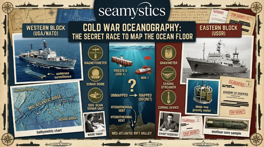
The US Navy poured roughly 14 billion dollars a year into oceanographic research during peak Cold War years, according to the Woods Hole Oceanographic Institution. That is a staggering figure for what most people assume was a niche academic field. In reality, Cold War submarine mapping became one of the best funded scientific pursuits of the twentieth century. Losing the acoustic advantage could mean losing a war.
The Secret Race to Map the Ocean Floor
Heezen and Tharp’s Classified Atlantic Map (1952 to 1957)
In 1952, geologist Bruce Heezen and cartographer Marie Tharp began compiling sonar depth readings at Columbia University’s Lamont Geological Observatory. Navy research voyages supplied most of that raw data. By 1957, the pair had produced the first comprehensive physiographic map of the North Atlantic seafloor. Historians now call this project central to military ocean mapping history.
Underwater Archaeology Methods Explained How Sunken History Gets Recovered
Here is the twist most textbooks skip. National security rules treated new bathymetric charts as “born classified.” Heezen and Tharp could not simply publish raw depth data. Instead, they chose an artistic, hand-drawn physiographic style. This let them reveal the ocean’s hidden terrain without breaking classification rules. Their map showed the Mid-Atlantic Ridge’s rift valley, a feature Tharp herself discovered. That single map later helped confirm plate tectonics, arguably the biggest scientific payoff ever to come out of a defense budget.
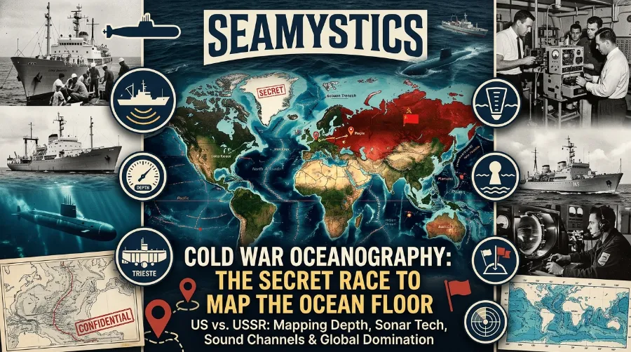
Cold War Oceanography The Secret Race to Map the Ocean Floor
SOSUS and the Sound That Tracked Submarines
Around the same period, researchers Maurice Ewing and J. Lamar Worzel made a key discovery at Woods Hole. They found the SOFAR channel, a layer of ocean water that carries low-frequency sound across huge distances with almost no energy loss. The Navy quickly saw the military value in this. It led directly to the SOund SUrveillance System, known as SOSUS. This network of seafloor microphones could detect a Soviet submarine’s faint acoustic signature from thousands of miles away, as Woods Hole Oceanographic Institution documents.
How Sonar Was Invented and Changed Ocean Exploration
This story connects closely to a broader one. Our sonar invention history guide traces how acoustic tools evolved from wartime necessity into everyday ocean science.
Submarines as Secret Surveyors
Submarines themselves became mapping vessels. Their crews often did not fully grasp the scientific weight of what they were doing.
- USS Queenfish (1970): Captain Alfred McLaren led this submarine beneath the Arctic ice pack to secretly chart the Siberian continental shelf. The crew mapped thousands of miles of uncharted seabed. They did this to prepare for possible Arctic warfare against the Soviet Union.
- Project Nekton and the Trieste (1960): On January 23, 1960, Jacques Piccard and US Navy Lieutenant Don Walsh piloted the bathyscaphe Trieste to the bottom of the Challenger Deep in the Mariana Trench. They reached roughly 35,800 feet. The Office of Naval Research funded the mission for one clear reason. As one Navy captain put it later, “the Cold War was on, who was better.”
- USS Thresher search (1963): The nuclear submarine Thresher sank with all hands aboard. Crews rushed the same Trieste vessel to the Atlantic seafloor to locate the wreckage, nearly 8,400 feet down. It was a grim but pivotal moment in deep-sea submersible history.
Want the engineering side of this story? Our guide on deep sea submersibles walks through what made dives like Trieste’s possible. Our piece on shipwreck salvage history covers how missions like the Thresher search shaped later deep-ocean rescue protocols.
British oceanographers ran a parallel and equally secretive program. In 1965, Britain’s National Institute of Oceanography built GLORIA, a towed sidescan sonar system. It eventually revealed tectonic plate boundaries and potential oil deposits across the North Sea and Atlantic. Royal Holloway University research shows GLORIA quietly boosted the UK’s economic and scientific standing. Cold War security concerns kept it tangled up for years anyway.
Why Cold War Ocean Research Still Shapes Science Today
It would be easy to dismiss all this as old naval history. But Cold War ocean research left fingerprints on nearly every branch of modern marine science. Consider these legacies:
- Plate tectonics theory, confirmed largely through classified sonar data turned public map
- Modern bathymetric survey techniques, refined directly from Navy sonar programs
- Submarine-based climate and current research, since Cold War subs also gathered temperature and salinity data
- International hydrographic cooperation, which eventually produced today’s open GEBCO ocean maps
There is a quieter legacy too. The ocean’s role in global climate did not become a mainstream research priority right away. Military oceanographers had already gathered enormous amounts of heat and current data, almost by accident, before anyone noticed its value. The World Meteorological Organization explains how the ocean absorbs and redistributes huge amounts of heat. Cold War era research vessels first observed this process at scale. Writers at The Marine Diaries have since traced how those early open-ocean voyages shaped our understanding of high seas climate patterns.
How Diving Bells Paved the Way for Modern Submarines
The Unfinished Map: Secret Ocean Mapping Continues Today
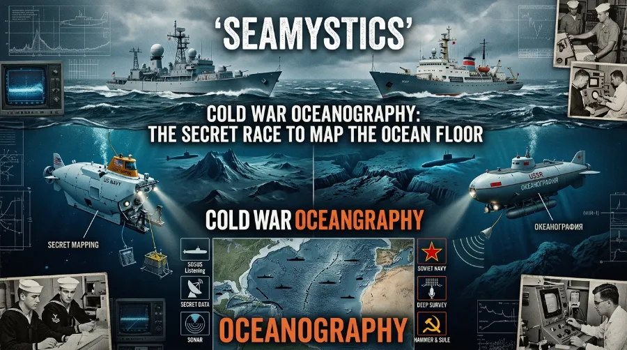
Here is the part that surprises most readers. Decades of Cold War submarine mapping, satellite gravity data, and modern sonar have still not finished the job. The Nippon Foundation-GEBCO Seabed 2030 Project reported only 23.4% of the global seafloor mapped to modern standards as of mid-2024. By June 2025, that figure had climbed to 27.3%. Teams mapped roughly four million additional square kilometres in a single year, an area comparable to the entire Indian subcontinent.
Lighthouse Navigation History: How Beacons Guided Sailors for 2,300 Years
That progress is uneven, though, and this matters if you care about where secret ocean mapping still lags.
- The North Atlantic and North Pacific are over a third mapped, largely thanks to decades of Cold War era survey data
- The Indian Ocean remains the least mapped major basin, at only about 17.5% coverage
- The extreme hadal zone below 6,000 metres is proportionally the best mapped depth band, ironically because it drew intense strategic interest
At the current pace of roughly 3.2% new coverage per year, researchers estimate teams could finally map the entire global seafloor within about 20 years. That would come nearly a century after the first Cold War sonar sweeps began. Our underwater photography history guide traces a parallel visual story: humans learning to actually see the deep ocean, not just measure it.
The Beagle Voyage Darwin Took How Five Years at Sea Rewrote Ocean Science
Frequently Asked Questions
Was Cold War oceanography really about science or mostly about war?
Both, honestly. Military competition drove the funding and urgency. But the resulting data on currents, seafloor shape, and plate tectonics became foundational to modern marine science.
What was the biggest scientific breakthrough to come out of this military research?
Plate tectonics confirmation stands out. The Heezen-Tharp Atlantic seafloor map, compiled from classified Navy sonar data through the 1950s, made this possible.
Is the ocean floor fully mapped today?
No. As of June 2025, teams had mapped only 27.3% of the global seafloor to modern high-resolution standards, according to the Nippon Foundation-GEBCO Seabed 2030 Project.
Why was so much of this research kept secret?
Detailed bathymetric charts could reveal safe submarine routes and hiding spots. Both the US and Soviet navies treated these maps as classified strategic assets for years.
Conclusion
Cold War oceanography began as a matter of national survival, not scientific curiosity. Yet it quietly produced some of the most important discoveries in Earth science history. Submarines built to hunt each other in silence ended up charting mountain ranges and trenches no one had ever seen. Nearly seventy years later, crews are still filling in that unfinished map, one sonar ping at a time. Some races never really end. They just change who is running them.
References
- Woods Hole Oceanographic Institution, “For the Navy, the Coast Isn’t Clear,” whoi.edu
- Doel, R.E., Levin, T.J., Marker, M.K., “Extending Modern Cartography to the Ocean Depths,” Journal of Historical Geography, 2006
- Nippon Foundation-GEBCO Seabed 2030 Project, World Hydrography Day announcement, seabed2030.org, 2025
- Niyazi et al., “Status of Global Seafloor Mapping Effort,” Frontiers in Marine Science, 2025
- US Naval Institute News, “Navy Celebrates 60th Anniversary of Trieste Dive,” news.usni.org, 2020
- Royal Holloway University of London / Science Museum Group, GLORIA research project archive