
Picture a robot gliding over seafloor that no person has ever seen, while you watch from your couch. That is not a movie scene. Ocean Exploration Trust does it for months every year, and anyone with an internet connection can ride along. This guide explains how the missions work, what the 2026 season is finding, and why the data matters to people far from the coast.
TL;DR: Ocean Exploration Trust (OET) is a US nonprofit that runs the research ship E/V Nautilus and streams its dives live. Between June and October 2026, the team is exploring deep-sea habitats in the central and western Pacific. All of the data is free and public, so scientists, officials and curious viewers can use it. noaaoceannews
| Topic | Key fact |
|---|---|
| Who runs it | OET, a nonprofit founded in 2007 by Dr. Robert Ballard |
| The ship | E/V Nautilus, about 68 meters long |
| Track record | 180 expeditions, 1,114 ROV dives, 1.3 million square kilometers mapped since 2009 |
| 2026 season | Five expeditions between June and October in the Pacific |
| Main robots | Hercules, Little Hercules and Atalanta, plus the partner AUV Sentry |
| How to watch | NautilusLive.org, streamed around the clock during expeditions |
| Data policy | Free and open to everyone |
I write about the deep sea for Sea Mystics, so I follow these dives closely. In this post, I combine the trust’s own records with public data from NOAA and Seabed 2030. I also add my own reading of what the numbers mean.
What Is Ocean Exploration Trust and Why Does It Matter?
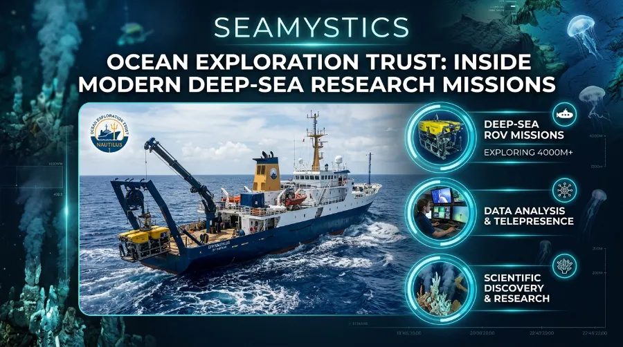
Ocean Exploration Trust is a nonprofit that explores the deep sea and shares every step with the public. Dr. Robert Ballard, the explorer who found the Titanic, founded it in 2007 to do pure ocean exploration. So the group puts discovery first and sharing right beside it. nautiluslive
Since 2009, the trust’s ship has built a solid record. The organization counts 180 expeditions, 1,114 ROV dives, 1.3 million square kilometers of seafloor mapped and 9,621 samples archived for public use. Its work has also fed more than 500 peer-reviewed publications. For scale, 1.3 million square kilometers is about the size of Peru. nautiluslivenautiluslive
Why should you care? The trust points out that the deep ocean shapes climate, supports fisheries and cycles nutrients. Because of that, it argues that we cannot protect what we have not seen. I think this framing is honest. OET does not promise to fix problems. It fills blank spots on the map, and someone has to do that job first. nautiluslive
The Five Deeps Expedition: Diving to the Bottom of Every Ocean
EV Nautilus Research: The Ship That Carries the Whole Program
The ship has an unusual past. East Germany built it in 1967 as a fisheries research vessel, and OET turned it into an exploration ship in 2008. Then a 2021 refit lengthened it to 68 meters and added a crane, more cabins and a mission control center. nautilusliveWikipedia
The numbers show it is built for long trips. Nautilus can stay at sea for up to 40 days, cruise at 10 knots and cover 13,000 nautical miles. A typical trip carries about 17 crew and around 31 science and mission staff. leewaymarineWikipedia
Here is what you will find on board:
- A deep-water mapping sonar that draws the seafloor before any dive
- A control van where pilots fly the ROVs
- Wet and dry labs for samples and digital data
- A satellite link that sends video and audio to shore
Practice insight: A 1967 hull still works because the trust treats the ship as a platform. The value sits in what gets bolted onto it. In 2026, partners from the NOAA Ocean Exploration Cooperative Institute bring extra tools aboard, including landers and autonomous vehicles. In other words, the ship stays useful as long as it can take in new technology. oceannews
Hercules and Friends: The Robots Doing the Deep Work
Nautilus never sends people to the bottom. Instead, it sends robots, and the crew steers them from the ship. That choice keeps scientists safe, and it also lets many experts share one camera view.
| Vehicle | Type | What it does |
|---|---|---|
| Hercules | ROV | Works down to 4,000 meters with cameras, lights and sampling tools |
| Little Hercules with Atalanta | ROV pair | Surveys the abyssal plain, with 2026 dives reaching about 5,800 meters |
| Sentry | AUV from WHOI | Maps the seafloor and takes images on its own |
| Orpheus | AUV (2025 visit) | Explores abyssal seafloor down to 6,000 meters |
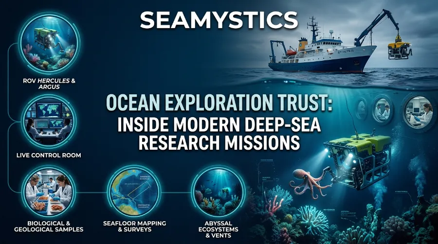
Hercules is the workhorse. It has six thrusters so pilots can fly it in any direction, and two arms for collecting samples and artifacts. Its high-definition video travels up a fiber-optic cable to the control van and then out to the world. Its lights add up to more than 60,000 lumens. ROV Hercules +2
That thin cable does a lot of quiet work. Companies such as DeRegt Cables publish plain notes on how ROV cables carry power and video at depth. Our own guide to deep-sea cables covers the wider network on the seabed.
NOAA Ocean Exploration: What the Agency Actually Discovers Each Year
Robots that steer themselves are growing fast in this field. To learn how they differ from tethered ROVs, read our explainer on autonomous underwater vehicles. Crewed subs still matter too. For example, the Alvin research submersible carries scientists to the bottom, while ROVs like Hercules keep the team dry and let dozens of experts watch at once. For the full picture, visit our ocean exploration technology hub.
How a Nautilus Live Expedition Works, Step by Step
Every Nautilus Live expedition follows a similar rhythm. Here is the flow, based on how the trust describes its work:
- Plan with local partners. Each expedition is planned with local stakeholders and community members in the region. noaa
- Map first. The ship runs its sonar to build a fresh picture of the seafloor.
- Pick dive sites. For example, the 2026 abyssal dives are placed close to sites that the AUV Sentry surveyed. nautiluslive
- Dive with the robots. Pilots fly the ROV while scientists call out what they see.
- Narrate live. Viewers watch the feed and send questions.
- Collect samples. Some finds come aboard for lab study.
- Share the data. The team archives everything openly.
The order matters. Mapping comes before diving because a good map tells you where to look. Without one, a dive is a guess.
Live Ocean Exploration: Why Telepresence Changes Science
Telepresence means people on shore join the expedition through video and chat. From June to October 2026, NautilusLive.org streams the expeditions 24 hours a day, and viewers can ask questions and get real-time updates. Classrooms join too. In 2025, the trust invited classes worldwide to talk with the at-sea team. ecomagazinenautiluslive
The trust also trains the next crew. For 2026, it chose nineteen interns from hundreds of applicants for its Science and Engineering Internship Program. That shows how the program builds people as well as data. nautiluslive
My view is simple. Live video works like open peer review. When a coral expert in one country and a geologist in another watch the same feed, they catch details a small ship crew might miss. Also, a public stream keeps the whole team honest, because everyone can see what the robot sees.
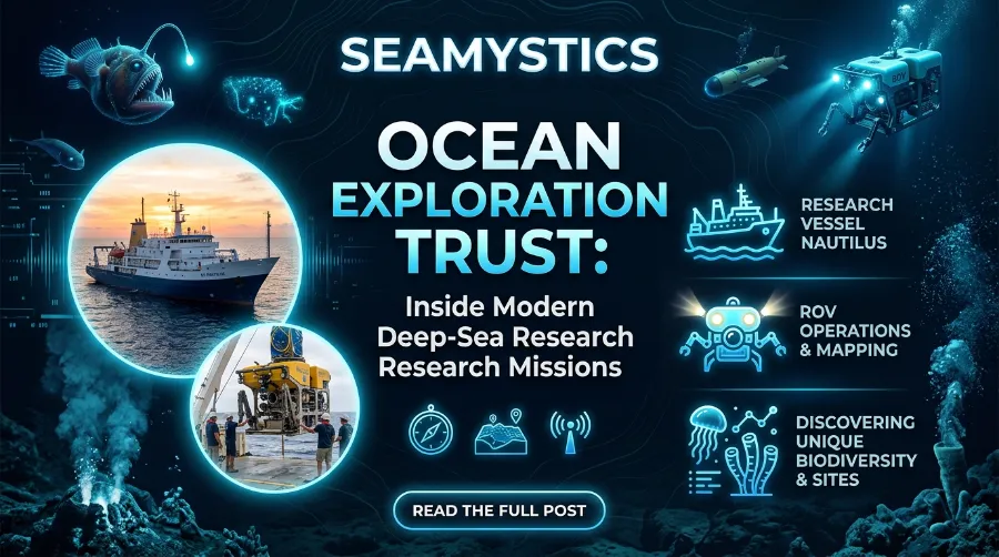
Ocean Exploration Trust: Inside Modern Deep-Sea Research Missions
2026 Ocean Exploration Trust Missions: A Season Overview
The 2026 season is sponsored mainly by NOAA Ocean Exploration through the Cooperative Institute, with extra support from the Bureau of Ocean Energy Management. Five expeditions cover the Mariana Islands, Wake Island and the Hawaiian Archipelago. noaaoceannews
| Expedition | Timing | Focus |
|---|---|---|
| Pacific Mapping | June 10 to 24 | Map new seafloor from Hawaii to Guam and test new sonar |
| Mariana Islands I (NA179) | June 28 to July 21 | Abyssal plain and seamounts in the southeast of the US zone |
| Mariana Islands II (NA180) | Starts July 25 | Abyssal plain in the northeast of the US zone |
| Wake Island | Later in the season | Seamounts, abyssal plain and possible war heritage sites |
| Hawaiian Archipelago | Later in the season | Unexplored ridges and seamounts |
Pacific Mapping: Testing a New Sonar
The season opened with a mapping run. It marked the first working deployment of the newly installed Kongsberg EM304 mapping system, a project with the University of New Hampshire’s Center for Coastal Ocean Mapping and Kongsberg. The crew also counted seabirds and other marine life from the observation deck. nautilusliveecomagazine
Mariana Islands I and II
The Marianas hold some of Earth’s most extreme ground. The first Mariana expedition focused on poorly known habitats in the southeast part of the US zone around the Northern Mariana Islands. The second moved to the northeast and also deployed a NOAA acoustic recorder to help monitor whales and dolphins. nautiluslivenautiluslive
Wake Island and the Hawaiian Archipelago
Wake Island adds history to the science. The team plans to study abyssal plains, unexplored seamounts and possible sites tied to the Battle of Wake Island, and to release a few Argo floats. In Hawaii, the focus is unexplored ridges and seamounts in the eastern part of Papahānaumokuākea, plus abyssal plains southwest of the main islands. The season runs through October, so check NOAA’s 2026 field season page for the latest schedule. ecomagazinenoaa
Case Study: The First Systematic Look at Ancient Seafloor
The best example from 2026 is NA179. One report on the mission’s wrap-up describes it as the first systematic visual survey of the ancient abyssal seafloor east of the Mariana Trench. The crew studied seafloor about 167 million years old over 23 days, covering nearly a quarter of US waters around the Northern Mariana Islands. techtimestechtimes
The gap in earlier data was huge. Before this season, the only visual surveys in that area came from nine ROV dives and six AUV dives on one trip in 2025. So each new dive added a large share of everything we know about the place. Three robots also worked as a team. The fleet included the AUV Sentry and a Wave Glider relay. techtimestechtimes
Life showed up at every depth. On the first Hercules dive of the season, the team went over 3,700 meters down to an unknown seamount and spotted two purple acorn worms. Later, Little Hercules found raised spirals in the sediment that turned out to be trails left by acorn worms feeding. nautiluslivenautiluslive
But people left a mark here too. At more than 5,800 meters deep, the ROV found trash that clearly came from humans. Another dive spotted a plastic balloon and ribbon. Groups such as Oceana campaign on ocean plastic and protection, and footage like this shows why the work matters. nautiluslivenautiluslive
Deep Sea Cables: The Hidden Infrastructure Beneath the Ocean
Why Seafloor Mapping Comes First
Mapping may sound dull, but it drives everything else. A good map shows where to send a robot, and it shows where hazards, ridges and habitats sit. Satellites can sense the ocean’s shape from space, which gives a rough outline. Ship sonar then adds the detail. For a simple primer, read our piece on satellite ocean mapping.
When the Seabed 2030 project began in 2017, only about 6% of the ocean floor had been mapped to modern standards. Since then the number has climbed each year. Here is the trend: hydro-internationalThe chart shows steady progress, but the picture is less rosy than it looks. In April 2026, Seabed 2030 announced that 28.7% of the world’s ocean floor is now mapped, with almost five million square kilometers added in the past year. That leaves roughly 71% still unmapped. The 2026 update also noted that 220 organizations now contribute to the effort, together covering 104 million square kilometers. ecomagazinehydro-international
| Year | Share mapped |
|---|---|
| 2017 | 6% |
| 2019 | 15% |
| 2023 | 24.9% |
| 2024 | 26.1% |
| 2025 | 27.3% |
| 2026 | 28.7% |
OET feeds this effort directly. Its mapping and ROV work supports Seabed 2030 and the US national strategy for ocean mapping and exploration. Also, each transit leg of the ship adds new lines to the grid, even when no dive is planned.
What the 2025 Season Added
The 2025 season set the stage for this year. Five expeditions covered the West Pacific, and you can watch the 2025 season preview on Nautilus Live. It opened in the Mariana Arc, an area with more than 60 submarine volcanoes and a back-arc spreading center where new seafloor forms.
Later, the team explored Iron Bottom Sound in the Solomon Islands. Five major naval battles took place there between August and December 1942, and they cost over 20,000 lives, 111 ships and 1,450 planes. Those sites now rest on the seafloor in a zone less than 25 nautical miles wide, in water about 1,400 meters deep.
The Marshall Islands trip showed the scale of the gap. That country has more than 1,200 islands surrounded by 2.13 million square kilometers of ocean, and most of it has never been mapped or surveyed. Not every plan went smoothly, though. A ship system repair forced the team to postpone the ROV portion of one Mariana expedition that year.
My Analysis: Strengths, Limits and Open Questions
As a marine biologist who writes about this field, I see four strengths and three limits in the trust’s model.
Strengths:
- Baseline data. The trust states that its data creates a baseline for future research and stewardship decisions. Baselines are boring, and they are also priceless. Without them, nobody can tell whether a deep-sea habitat has changed.
- Open access. Free data means small labs and small nations can use it too.
- Multi-robot teamwork. Pairing ROVs, AUVs and a Wave Glider covers more seafloor per day than one robot could.
- Public trust. A live stream makes the science easier to believe.
Limits:
- Funding depends on a few sponsors. The 2026 season leans mainly on NOAA through one cooperative institute, so a budget change could hit the schedule fast.
- Old ship, real risk. The 2025 repair delay shows how one broken system can reshape a mission.
- Depth limits. Hercules works to 4,000 meters, so abyssal work at 5,800 meters needs the towsled pair.
There is one theme I watch closely. The trust says its 2026 data will describe marine critical minerals and the places where they occur. Deep-sea mining is a contested topic, and reasonable people disagree about it. My view is limited to this: good baseline data should come before any big decision. Whatever side you take, you want the facts on the table first.
Open Data and Trust With Local Communities
The trust makes all Nautilus data free and public for researchers, governments, conservation groups and communities. OET President Allison Fundis has described this as a policy that has stayed the same for eighteen years: explore responsibly, invite people in, and give everyone equal access to the results.
Alvin Research Submersible and Nautile: Famous Research Submarines Explained
The team also works as a guest in Pacific waters with deep Indigenous and cultural histories. It says it is working to earn and keep the trust of those communities. That approach is smart, because good science depends on good relationships in the places you study.
How to Follow Live Ocean Exploration Yourself
You do not need a lab coat. Here are simple ways to join:
- Watch dives on NautilusLive.org while an expedition is running
- Send questions through the site or social media during a dive
- Bookmark the NOAA Ocean Exploration page for schedules and updates
- Ask your teacher to book a classroom chat with the at-sea team
- Look into the internship program if you study science or engineering
If you like this topic, also read our related posts on ocean technology on Sea Mystics.
Frequently Asked Questions
What is Ocean Exploration Trust?
It is a US nonprofit founded in 2007 that explores the deep ocean with the ship E/V Nautilus and shares its dives live.
Who founded it?
Dr. Robert Ballard, the explorer who found the Titanic.
How deep can ROV Hercules dive?
Hercules can work down to 4,000 meters. For deeper abyssal plains, the team uses the towsled Little Hercules and Atalanta pair.
Where can I watch a Nautilus Live expedition?
Go to NautilusLive.org during expedition months. In 2026, the streams run from June to October.
Is the data free to use?
Yes. The trust makes all data from its expeditions free and public.
How much of the ocean floor has people mapped?
About 28.7% by 2026, according to Seabed 2030.
Quick Quiz: Test Your Deep-Sea Knowledge
- Who founded Ocean Exploration Trust?
A) Sylvia Earle B) Robert Ballard C) Jacques Cousteau - How deep can ROV Hercules work?
A) 1,000 meters B) 4,000 meters C) 11,000 meters - What share of the ocean floor has Seabed 2030 counted as mapped in 2026?
A) 8.7% B) 28.7% C) 58.7% - True or false: Nautilus data is only for OET scientists.
- True or false: Hercules always works alone.
Answers: 1) B. 2) B. 3) B. 4) False, because the data is free and public. 5) False, because Hercules works as a pair with Argus or Atalanta.
Conclusion
Ocean Exploration Trust shows that deep-sea science can be open, live and useful. Its ship, robots and telepresence link turn hidden places into shared knowledge. The 2026 season adds more, with new maps, first looks at ancient seafloor and a steady reminder that human trash reaches even 5,800 meters down. Follow a dive this season, and you will see why the unknown ocean still matters.
References
- Ocean Exploration Trust, About OET and E/V Nautilus pages, nautiluslive.org
- NOAA Ocean Exploration, E/V Nautilus 2026 Field Season and 2026 Expeditions pages
- Ocean Exploration Trust, 2026 Exploration Season launch announcement (May 21, 2026)
- Ocean Exploration Trust, expedition pages for NA171, NA179 and NA180
- Nautilus Live video posts on the 2026 Mariana dives and abyssal plain biodiversity
- Nautilus Live, OET 2025 Expedition Season Preview (May 6, 2025)
- Nippon Foundation-GEBCO Seabed 2030, Global seabed mapping update (April 20, 2026)
- Hydro International, Seabed 2030 coverage reports (2026 and earlier)
- Tech Times, E/V Nautilus wraps first Mariana abyssal survey (July 2026)
- Wikipedia, EV Nautilus (vessel and Hercules specifications)