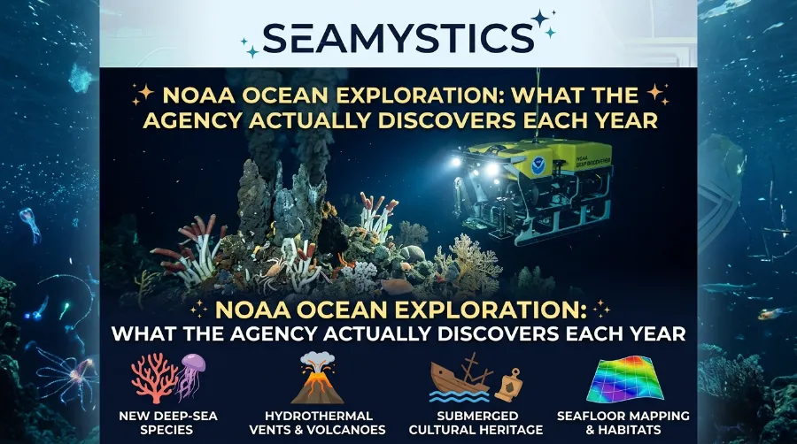

Most of the ocean floor has never had a proper look. Each year, NOAA ocean exploration sends one research ship and two robots into that gap, and the results still surprise the scientists on board. In 2025, the program and its partners mapped 131,222 square miles of seafloor, filmed the hangar deck of the USS Yorktown about 5 kilometers down, and spotted animals that nobody has named yet. This guide shows what the agency really finds in a normal year, what counts as a real discovery, and how you can watch the next one live.
TL;DR: In a normal year, NOAA’s exploration program maps unsurveyed seafloor, films deep-sea animals and habitats, and visits shipwrecks. In 2025 that meant 131,222 square miles mapped, 127 days at sea on the main ship, and possible new species in Hawai‘i and Palau waters. Naming a species takes years, so the biggest “discovery” is often a public dataset that other scientists use later.
Key takeaways
| Question | Short answer |
|---|---|
| Who runs it? | NOAA’s exploration office, the only federal program built to explore the unknown ocean |
| Main ship | NOAA Ship Okeanos Explorer |
| Area mapped in 2025 | 131,222 square miles (about 340,000 square kilometers) with partners |
| Days at sea in 2025 | 127 days on Okeanos Explorer across six expeditions |
| Biggest 2025 finds | Yorktown hangar deck, a giant hydroid, 113 Palau seamounts mapped |
| Best 2026 news | The golden orb identified, plus the first eDNA datasets |
| Where the ship is now | In port in Fiji, heading back to American Samoa on September 24 |
I write about the deep sea for Sea Mystics, and I read expedition reports the way a biologist reads field notes. First, I ask what the team saw. Then I ask what they can prove. That second question explains most of the gap between exciting headlines and the slower science that follows.
What NOAA Ocean Exploration Actually Does
Exploration means looking first and asking questions later. Since 2001, NOAA’s exploration office has worked to fill gaps in basic knowledge of the deep ocean. Regular research often tests one idea in one place. Exploration instead collects broad data that many teams can reuse for years.
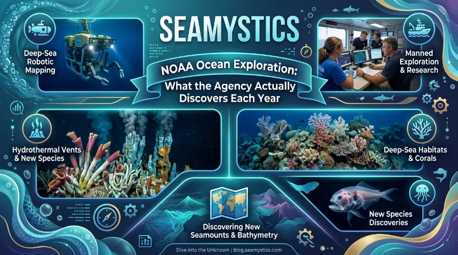
The office works in three main ways. It runs expeditions on the ship Okeanos Explorer, it funds the Ocean Exploration Cooperative Institute (OECI), and it gives out competitive grants each year. The OECI backs other vessels too, such as the Exploration Vessel Nautilus. Together, these channels cover more ocean than one ship could reach alone.
The Five Deeps Expedition: Diving to the Bottom of Every Ocean
Government ocean exploration also follows a rule that many private cruises skip. The data go into national archives, so anyone can download them. As a result, one dive can help a student, a coral scientist in Europe, and a resource manager in the Cook Islands at the same time.
If you want the bigger picture of the tools behind this work, our ocean exploration technology guide covers ships, sensors, and robots in one place.
How NOAA Okeanos Explorer Finds New Things
NOAA Okeanos Explorer joined the fleet in 2008, and it is the only federal vessel dedicated to exploring the largely unknown ocean. It works in two shifts. At night, sonar maps the seafloor. By day, two robots named Deep Discoverer and Seirios dive to check what the maps show. noaa
Deep Discoverer handles the sampling and imaging, while Seirios lights the dark sea around it. Live video travels to the ship and then to shore, so experts on land can join a dive as it happens. NOAA calls this telepresence. For a small crew at sea, it adds a lot of extra pairs of eyes. noaa
Mapping shapes the dive plan more than most people expect. In 2025, the team studied fresh sonar data from an unnamed seamount in Papahānaumokuākea, spotted hummocked ridges, and changed that day’s dive plan to visit them. That is a good example of how the ship finds new things. The map points the way, and the robot confirms it.
Not every deep-sea tool needs a cable. Autonomous vehicles swim on their own, and our guide to autonomous underwater vehicles explains when scientists pick them over tethered robots.
Each season also starts with tests. In 2026, after a dry dock stay in Ketchikan, Alaska, the ship began with an expedition off Hawai‘i to calibrate its sonars and check its mapping systems. That work sounds dull, but it keeps the data reliable. noaa
Ocean Exploration Trust: Inside Modern Deep-Sea Research Missions
NOAA Ocean Missions Start With Maps
Maps are the least glamorous discovery and the most useful one. Every one of the NOAA ocean missions I follow begins with unsurveyed seafloor, because a team cannot dive on a place it cannot see. Here is how the 2025 mapping total breaks down.
| Area mapped in 2025 | Square miles | Share of total |
|---|---|---|
| U.S. Exclusive Economic Zone | 40,448 | 31% |
| Palau Exclusive Economic Zone | 37,482 | 29% |
| Cook Islands Exclusive Economic Zone | 5,461 | 4% |
| Other waters, including Micronesia and the Marshall Islands | 47,831 | 36% |
| Total | 131,222 | 100% |
The last row is my own subtraction from NOAA’s reported total, and the shares are my math too. Notice that only about a third of the mapping happened in U.S. waters. Most of it happened in partner nations’ waters, which fits the program’s shift toward shared exploration with island governments.
In 2025, the program also passed 3 million square kilometers mapped by Okeanos Explorer since 2008. Between July and October alone, the team mapped 113 seamounts in Palau’s waters.
Now compare years. The 2024 report listed 443,304 square kilometers (171,161 square miles) of unmapped or poorly mapped seafloor. The 2025 total came in about 23 percent lower. The reports do not explain the drop. My guess is the mix of days, since dive days use ship time that mapping days would otherwise fill, but that is my reading and not an official reason. noaa
Zoom out and the job stays huge. The Seabed 2030 project reported in April 2026 that 28.7 percent of the world’s ocean floor now has a modern map, up from 27.3 percent the year before. A total of 220 organizations have contributed data. At 1.4 points per year, the last 71 percent would take about 50 years, so the 2030 goal needs a much faster pace. You can read the source announcement on the GEBCO release page. gebcohellenicshippingnews
Satellites give the broad view, and ship sonar adds the sharp detail. To see how the two fit together, read our satellite ocean mapping guide.
Strange Animals and the Truth About New Species
What the 2025 dives showed
Around Papahānaumokuākea, the science team met a long list of unfamiliar life. They saw a solitary hydroid wider than a meter, the largest that team had ever seen. They also found fields of sea lilies, comb jellies, a predatory chiton, a sea slug, and a glass sponge that may all be new to science. One coral, about 80 centimeters long, mixed traits from two known groups. noaa
Big corals told another story. Large Hemicorallium colonies, many wider than a meter, covered the ridges of one seamount. Because these corals grow slowly, the team wrote that many were likely hundreds of years old.
Partner ships added to the tally. On E/V Nautilus, the team recorded more than 400 kinds of animals in Cook Islands waters, and most were first records for that area. A very rare deep-sea squid of the genus Magnapinna drifted into view. Casper, the ghostly white octopod, also showed up again at over 4.1 kilometers deep.
Deep Sea Cables: The Hidden Infrastructure Beneath the Ocean
Older cruises show the scale over time. The 2021 North Atlantic Stepping Stones expedition gathered data on 20 seamounts that nobody had mapped before. On one dive, viewers spotted a yellow sponge and a pink sea star that looked like SpongeBob and Patrick. noaa
Why a “new species” takes years to confirm
Here is the catch. A sighting is not a species description. NOAA says it depends on taxonomists, often outside the expedition team, to judge what a find means and to name it when that is right. Sometimes the process works well, and taxonomists named a sea star Sibogaster bathyheuretor in honor of Deep Discoverer. noaanoaa
The slow cases teach more. Casper first appeared in 2016, and it still has no formal description in 2025. The sea lily family Phrynocrinidae showed up in 2010 off Indonesia, again in 2017 in the Phoenix Islands, and again in 2025. Even so, that animal has no name.
In my view, counting “new species” each year is the wrong scorecard. A better score is what teams collect and share. Samples go to museums, video goes into archives, and the program is working to make biological data submissions to the global databases OBIS and GBIF a regular part of its workflow. Those records help taxonomists find the right specimen years later. noaa
Case study: the golden orb, solved in 2026
The golden orb shows how slow this work can be. On August 30, 2023, Deep Discoverer found the golden, mound-shaped object in the Gulf of Alaska. It sat on a rock about 3,250 meters down, with a hole in its side. People guessed an egg case, a dead sponge, even alien technology. alaskasnewssource
Early DNA barcoding failed. Whole-genome sequencing then showed the DNA matched a giant deep-sea anemone, Relicanthus daphneae. NOAA announced that the orb is a leftover of dead cells from the base of the anemone, the part that gripped the rock. You can read the agency’s own account in the official NOAA release. alaskasnewssourceoceannews
Two lessons stand out. First, one odd object took two and a half years and experts in genetics, anatomy, and computing. Second, a similar sample from 2021 helped confirm the answer, which shows why teams keep specimens.
NOAA Deep Sea Research on Coral, Sponge, and Vent Habitats
Habitats often matter more to managers than any single animal. In June 2026, researchers published a study of Alaskan waters that counted 15,531 coral and sponge observations across 75 hours of video. They sorted the footage into 74 coral types and 90 sponge types. They also flagged eight dense habitats that count as vulnerable marine ecosystems. The full summary of the Alaska study explains the method.
That result shows what NOAA deep sea research can do when video sits in a public archive. Outside authors reuse the footage, and they can answer questions the original team never asked. In other words, one cruise keeps producing science long after the ship goes home.
Habitat work also drives repair projects. In March 2026, the office announced a livestreamed expedition to help restore deep-sea coral in the Gulf of Mexico, where the 2010 Deepwater Horizon spill injured coral habitats. You can see the restoration livestream announcement for details.
Vents and volcanoes change too. At the Hafa Adai vent field in the Mariana region, Nautilus found that a huge black smoker chimney seen in 2016 had toppled, and a new one was growing in its place. At Ahyi Seamount, mapping showed major changes since the last survey, including a newly formed summit ridge inside a bubble plume.
Repeat visits deserve more attention than they get. A first visit gives a snapshot, while a second visit shows change. I think the most valuable deep-sea data in the next decade will come from revisits, not first looks.
Shipwrecks and Maritime Heritage
Every year, the program also finds human history. In March 2025, the Okeanos Explorer team dived on the USS Nevada at 4.7 kilometers, the deepest maritime heritage dive the program had done. A month later, two dives on the USS Yorktown, at about 5 kilometers, broke that record.
Alvin Research Submersible and Nautile: Famous Research Submarines Explained
The Yorktown dives explored the carrier’s hangar deck for the first time. The team found a car, likely a 1941 Ford Super Deluxe “Woody,” and a hand-painted world map mural inside an elevator shaft. They also found at least three aircraft, which were the first planes ever found underwater on the Battle of Midway battlefield. One of them had landed on the Yorktown after a battle-damaged run from the USS Enterprise’s Bombing Squadron Six. The mission story on the Yorktown dives tells the full account.
Nautilus added to the list in the Solomon Islands. Its team surveyed 13 historic sites from the Guadalcanal battles in Iron Bottom Sound, and two were new finds. It also explored the severed bow of the USS New Orleans, about 675 meters down, for the first time.
Why does a marine biology site care about wrecks? Because ships turn into reefs. Anemones, corals, and sponges settle on steel, so the same dives that record history also record life.
Beyond the Ship: Partners, DNA, and Open Data
Okeanos Explorer does not work alone. Through the OECI, the program backed seven E/V Nautilus expeditions in 2025, with 113 days at sea across the central, western, and southern Pacific. Our profile of the Ocean Exploration Trust explains how that nonprofit runs the ship.
Crewed submersibles join in as well. In the Aleutian Arc, a federal and academic team mapped 18,103 square kilometers and used Alvin to check the maps on the seafloor. Our Alvin research submersible guide covers how that vehicle works.
DNA is the newest tool. In May 2026, the program released its first environmental DNA datasets from Okeanos Explorer, working with NOAA Fisheries, the Smithsonian’s Ocean DNA Program, and NOAA’s Atlantic Oceanographic and Meteorological Laboratory. Water carries traces of animals that never pass in front of a camera. As a result, eDNA can count life that a robot misses. The eDNA release story explains the first results.
Grants and teaching matter too. In 2025, grant winners tested ways to survey deep shipwrecks in Wisconsin Shipwreck Coast National Marine Sanctuary and taught underwater vehicles to find and follow deep-sea animals on their own. Meanwhile, the office supported 27 educator workshops that reached 605 teachers.
NOAA Ocean Missions in 2026: Where the Ship Is Now
The 2026 season moves across the Pacific in a clear order. Here are the main legs.
| Expedition | Dates in 2026 | Focus |
|---|---|---|
| Mapping Shakedown (EX2602) | April 29 to May 6 | Test sonars, network, and telepresence off Hawai‘i |
| ROV Shakedown (EX2603) | May 16 to June 5 | Test Deep Discoverer and Seirios |
| Pacific Islands Mapping (EX2604) | June 16 to July 9 | Map deep water near Hawai‘i, Kingman Reef, Palmyra Atoll, Jarvis Island, and the Cook Islands |
| Cook Islands ROV Exploration (EX2605) | July 19 to August 13 | Dives and mapping in Cook Islands waters |
| American Samoa ROV + Mapping (EX2606) | August 20 to September 17 | Seamounts, coral and sponge habitats, minerals, water column |
| American Samoa Mapping | Starts September 24 | Fill mapping gaps on the way to Hawai‘i |
As of September 21, 2026, the ship sits in Suva, Fiji, after it finished the American Samoa cruise on September 17. The next leg starts on September 24 and focuses on mapping American Samoa’s waters before the ship heads to Hawai‘i. Dates can shift with weather and ship needs, so check the Okeanos Explorer status page before you plan to watch. noaanoaa
The Cook Islands cruise stands out. It ran with the Cook Islands Seabed Minerals Authority to support decisions under Cook Islands law, and the average depth in that zone is about 5,000 meters. That makes it deep even by this program’s standards. In June 2026, the office also asked the public for input on proposed 2027 operating areas in the Pacific. noaa
Why Government Ocean Exploration Matters to You
Some readers ask why a public agency should explore the deep at all. My answer is simple. Baseline data can only be collected before things change. Once a seabed gets mined, cabled, drilled, or trawled, nobody can go back and measure what it looked like.
Consider the practical users. Planners can use seafloor maps to route deep-sea cables around steep slopes and hazards. Fisheries managers use coral and sponge maps to protect habitat. Island governments, such as the Cook Islands, use survey data when they weigh choices about seabed minerals. Teachers use the free video to bring the deep into class.
Europe and the UK share this stake too. GEBCO is a joint program of the International Hydrographic Organization and UNESCO’s ocean commission, so the map belongs to a global audience. The Atlantic is a shared ocean, and public grids serve teams on both sides of it.
How to Follow the Next Discovery Yourself
You do not need a lab to watch this work. Follow these steps.
- Check the ship’s status on the Okeanos Explorer page to see whether it is at sea or in port.
- Open the livestreams page during dive days. On the American Samoa cruise, video streamed from about 8 a.m. to 8 p.m. local ship time, and NOAA warned the schedule could change. Convert the time to your zone first. noaa
- Read the expedition plan to learn what the team hopes to find. Then compare it with the daily updates.
- Visit the news page after each cruise for summaries and follow-up studies.
- Download raw records from the archive of Okeanos Explorer ROV cruises if you want to check the numbers yourself.
For deeper reading, three NOAA pages work well together. The Ocean Science for Everyone hub suits classrooms and curious readers. The archive of expeditions from 2001 to 2018 lets you compare older finds with new ones. Then the news page keeps you current.
One practice tip from years of reading these logs: listen for the words “possible” and “may be.” The team uses them on purpose, and they tell you what is still unproven.
Common Mistakes When You Read Discovery Headlines
Headlines round up, and reports round down. These habits help you read both.
- Treating “possible new species” as confirmed. Formal naming takes years, and Casper is the proof.
- Comparing yearly mapped area without context. The 2025 total includes partner mapping and waters of other nations.
- Reading a livestream comment as a result. Scientists talk through guesses on air, and the real answer comes later.
- Assuming old finds are closed cases. The golden orb took two and a half years, and some animals wait even longer.
- Ignoring revisits. A second look at a vent or seamount often shows more than the first.
Frequently Asked Questions
What does NOAA’s exploration office do?
It explores parts of the ocean that people know little about. It runs expeditions on Okeanos Explorer, funds the OECI and its partner ships, and gives grants for new tools and methods. All its data go into public archives.
What is NOAA Okeanos Explorer?
It is the only federal ship dedicated to exploring the largely unknown ocean. It maps the seafloor at night and sends the robots Deep Discoverer and Seirios down by day. Live video streams to scientists and the public.
How much of the ocean floor has a modern map?
Seabed 2030 reported 28.7 percent in April 2026, up from 27.3 percent a year earlier. In 2017, the figure was about 6 percent.
Does the ship find new species every year?
It finds possible new species almost every cruise, but formal descriptions take years. Taxonomists must study specimens before they can name them. Casper, first seen in 2016, still has no name.
Can the public watch dives live?
Yes. NOAA streams ROV dives online during expeditions, and the schedule appears on the livestreams page. Times can change, so check before you tune in.
Where is Okeanos Explorer right now?
As of September 21, 2026, it sits in Suva, Fiji. Its next expedition, American Samoa Mapping, starts on September 24.
Test Yourself: 5-Question Quiz
- Which vessel is the only federal ship dedicated to exploring the largely unknown ocean?
a) E/V Nautilus b) NOAA Okeanos Explorer c) R/V Atlantis - About how deep did the 2025 dives on the USS Yorktown go?
a) 500 meters b) 2 kilometers c) 5 kilometers - What did scientists find the golden orb to be?
a) An egg case b) A dead sponge c) The base of a giant deep-sea anemone - True or false: A sighting of a possible new species is the same as a formal species description.
- True or false: As of April 2026, more than half of the ocean floor has a modern map.
Answers: 1) b. 2) c. 3) c. 4) False, because taxonomists must study and describe the species first. 5) False, because Seabed 2030 reported 28.7 percent.
Conclusion
So what does NOAA ocean exploration discover each year? Mostly three things: maps, living things, and history. In 2025, that meant 131,222 square miles mapped, a giant hydroid, coral that may be centuries old, and a carrier’s hangar deck seen for the first time. In 2026, it also meant a solved mystery and the first eDNA datasets.
The most important output is not a headline. It is public data that lets other scientists confirm, name, and protect what the ship finds. Watch the next dive, read the plan, and pay attention to the careful words. That is how real discovery sounds.
References
- NOAA’s exploration office, 2025 Annual Report (2026)
- NOAA’s exploration office, 2024 Annual Report
- Okeanos Explorer status and 2026 expeditions pages, including EX2602 and EX2605
- NOAA news release: Scientists Reveal Identity of Mysterious Golden Orb (April 22, 2026)
- New Pathways to Discovery: Publishing Data on Global Databases (July 9, 2026)
- Researchers Identify Dense Coral and Sponge Communities in Deep Alaskan Waters (June 18, 2026)
- GEBCO, Release of the GEBCO_2026 Grid (April 27, 2026)
- Deep-Sea Biological Discoveries, 20th anniversary series
- 2021 North Atlantic Stepping Stones expedition summary
- NCEI archive of Okeanos Explorer ROV cruises