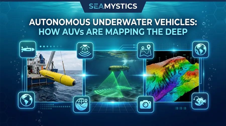

More than 70% of the ocean floor still has no modern map. In fact, Seabed 2030 reports that only 28.7% of the seafloor is charted as of 2026. Autonomous underwater vehicles, or AUVs, are the robots that swim into that blank space, work alone for hours or weeks, and bring back the first clear look. In this guide, I explain how they work, what they found, and where the field goes next. ecomagazine
TL;DR: An AUV is a cable-free robot submarine. It follows a plan you set before the dive, scans the seafloor with sonar and cameras, and holds the data until you pick it up. Most research AUVs reach 6,000 meters, and one new design reaches 11,000 meters. Still, only 28.7% of the seafloor has a modern map.
| Key question | Short answer |
|---|---|
| What is an AUV? | A robot sub with no cable and no pilot that follows a set mission |
| How does it find its way? | Inertial navigation, a Doppler velocity log, and acoustic fixes from a ship |
| What does it map with? | Multibeam, side-scan, and sub-bottom sonar, plus cameras |
| How deep can it go? | 6,000 meters for most research vehicles, 11,000 meters for Deep Venture |
| How much seafloor has a modern map? | 28.7% as of April 2026 |
| How big is the market? | About $3.3 to $3.8 billion in 2026, depending on the analyst |
| AUV or ROV? | AUVs survey wide areas alone, while ROVs grab and sample with a pilot |
What Are Autonomous Underwater Vehicles and Why Do They Matter?
A robot with no cable and no pilot
An AUV is a self-driving submarine robot. Because it has no cable to a ship and no pilot at a joystick, it works alone. Instead, researchers plan the route before the dive, deploy the robot, and download the data after it comes back. As a result, the ship’s crew can do other work while the robot dives. noaa
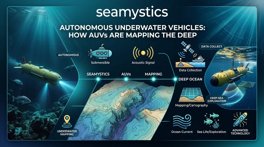
The idea has a long history. Engineers built the first AUVs in the 1960s, and by the 1980s some were made for deep-sea mapping. Still, the last ten years changed the field. Better batteries, smaller sensors, stronger inertial navigation, and faster onboard computers all arrived together. So autonomous ocean robots now handle jobs that once needed a big ship and a large crew. noaaforcys
Why the seafloor map matters
Why should a reader who never gets wet care? First, the seafloor shapes almost everything else in the ocean. It steers deep currents, hides fault lines, shelters fish and corals, and decides where cables and wind farms can go. Without a map, all of those choices rest on guesswork.
As a marine biologist, I read a seafloor map the way a hiker reads a trail map. Ridges, canyons, and flat plains tell me where life clusters. For example, MBARI’s maps help researchers spot hydrothermal chimneys, faults, and lava flows. mbari
The Five Deeps Expedition: Diving to the Bottom of Every Ocean
If you are new to this topic, our ocean exploration technology guide covers the wider toolkit, from sonar to crewed submersibles. Also, the MIT News AUV archive lists 12 stories, including 2026 work on robots and divers teaming up. mit
Satellite Ocean Mapping: How Space Technology Studies the Sea
AUV Technology Explained: The Parts That Make It Work
A modern AUV looks simple from the outside. Inside, however, several systems must work together, and one failure can end the mission. For example, a NOAA Teacher at Sea log from 2016 names three that must all work on the REMUS 600: navigation, communication, and sensors. noaateacheratsea
Power and body shape
Most AUVs run on specialized batteries, although some have used fuel cells or solar recharging. Gliders, however, take a different path because they let buoyancy and gravity move them to save energy. Body shape also varies. Some vehicles have torpedo shapes with strong thrusters for speed, while others have wider bodies built to handle crushing pressure. What is an AUV? – NOAA Ocean Exploration +2
Sensors
The sensor list depends on the job. Mapping vehicles, for instance, carry sonar, cameras, and depth sensors. They also carry a conductivity and temperature sensor, since sound speed in the water shapes how the sonar beams form. noaateacheratsea
The brain and the mission plan
Planners write the route before launch. At MBARI, teams plan missions over the best existing map, usually from a ship’s sonar, so the vehicle can hold a safe, steady height above the bottom. A 2013 NOAA log adds a useful detail. The vehicle steers by altitude instead of depth, using four beams to measure its gap above the seabed. Because of this, the person who programs the route does not have to plan around every hill. mbarinoaateacheratsea
Communication
NOAA Ocean Exploration: What the Agency Actually Discovers Each Year
Radio and GPS stop at the waterline. In fact, those signals cannot pass through seawater, so a diving AUV relies on slow acoustic messages and inertial navigation. Once it reaches the surface, it can use GPS, wireless, or satellite links. On the 2016 NOAA cruise, for example, the REMUS 600 rose about every hour to make a satellite call, then went back down. usmnoaateacheratsea
How AUVs Find Their Way Without GPS
Dead reckoning step by step
Here is a puzzle. A robot dives 3,000 meters, swims for a day, and must come back to the same spot. Since GPS does not work down there, how does it know where it is?
First, the AUV uses dead reckoning. It starts from its last GPS fix, then tracks its own speed, acceleration, and turns with an onboard inertial system, while a pressure sensor gives depth. Next, a Doppler velocity log measures speed over the bottom. On MBARI’s mapping AUVs, the log locks onto the seafloor once the vehicle comes within 130 meters. In deeper water, the ship tracks the vehicle with acoustic signals on the way down until the log locks on. Autonomous Underwater Vehicle – an overview +2
Why navigation sets map quality
Small errors add up, though. For that reason, navigation quality sets map quality. Kongsberg says its HUGIN Superior holds position error below 0.04% of distance traveled. On a 100 kilometer run, my math puts that at about 40 meters. kongsberg
My take is simple. A great sonar with weak navigation gives a blurry map, because the software cannot stitch the passes together cleanly. So people who compare AUVs by sonar specs alone miss half the story.
Underwater Drone Mapping: How Sound Becomes a Seafloor Map
From echo to image
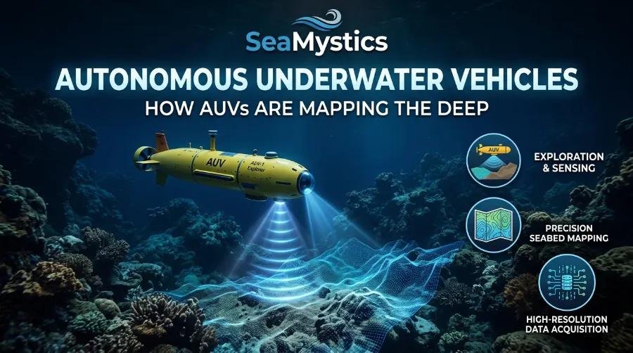
Underwater drone mapping works a lot like a bat’s chirp, only slower. First, the AUV sends out sound and listens for the echo. Then the time the echo takes and the energy it returns reveal the shape and hardness of the bottom. mbari
To cover a whole area, the robot follows a simple pattern. It runs back and forth across the target zone, much like a lawn mower, until coverage is complete. Meanwhile, each sensor adds a different layer to the final picture.
| Sensor | What it shows | Plain example |
|---|---|---|
| Multibeam sonar | Depth and shape of a wide strip | A 3D model of a canyon |
| Side-scan sonar | An image of the bottom, hard or soft | Spotting a wreck or a rocky patch |
| Sub-bottom profiler | Layers below the seabed | Sediment layers and faults |
| Cameras | Real photos | Counting corals or reading a ship’s name |
| CTD sensor | Temperature, salt, and conductivity | Correcting how fast sound travels |
Detail and speed
Height above the bottom controls detail. For example, MBARI’s mapping AUVs reach one meter horizontal resolution when they fly 50 meters above the seafloor. Because they sit closer to the bottom, they map at finer resolution than sonar on a ship’s hull. Meanwhile, WHOI’s Sentry builds 3D models with detail as fine as 20 inches per pixel and takes a photo every three seconds. Mapping Sur Ridge • MBARI +2
Ocean Exploration Trust: Inside Modern Deep-Sea Research Missions
Speed matters as well. Kongsberg says HUGIN Superior covers about 4.5 square kilometers per hour with next-generation synthetic aperture sonar and multibeam. Also, its bigger sibling, HUGIN Endurance, can cover close to 1,000 square kilometers in a single dive. kongsbergecomagazine
Cameras add richer detail but face murky water. In fact, WHOI engineers note that darkness and floating particles distort images, so software must clean them before building maps. whoi
AUV Ocean Research: Real Missions and What They Found
Boaty McBoatface: under Antarctic ice and across the Atlantic
The UK’s National Oceanography Centre runs a fleet of Autosub Long Range vehicles, and the most famous one has a silly name. In its first Antarctic trip, Boaty traveled 180 kilometers over three days through underwater valleys, measuring temperature, saltiness, and turbulence. As a result, scientists learned more about how stronger Antarctic winds link to warming deep water. sciencedailyeurekalert
Then came a harder test. In early 2018, Boaty spent 51 hours under the Filchner Ice Shelf, covered 108 kilometers, and reached 944 meters beneath ice 550 meters thick. Later, in 2022, it swam five weeks and 2,000 kilometers from Plymouth, diving past 1,000 meters and surfacing every 24 hours. Because of the satellite link, NOC says scientists can change a mission when something interesting appears. Learn more on NOC’s long-range AUV page. Boaty Mcboatface Completes First Antarctic Mission +2
Endurance22: finding Shackleton’s ship
On 5 March 2022, the Endurance22 team found Shackleton’s ship. It lay 3,008 meters down in the Weddell Sea, about six kilometers south of the position Captain Worsley recorded. Saab’s Sabertooth vehicles found, filmed, and documented the wreck. You can read the full account in Saab’s press release. sciencefocussaab
This case shows something I stress often. An AUV does not only make maps. In addition, it finds things that people missed for more than a century.
Sentry: a workhorse with 500 dives
WHOI’s Sentry reached its 500th dive on 16 October 2018. Along the way, it helped map the seafloor, track the Deepwater Horizon oil spill, and locate the voyage data recorder of the sunken ship El Faro. Also, it dives to 6,000 meters and can stay down up to 40 hours. whoinoaa
Norway and Ocean Infinity: mapping at scale
This summer, Norway sent its new HUGIN Superior on a first expedition. The vehicle works to 6,000 meters, and the Norwegian Marine Data Centre at the University of Bergen will operate it. Meanwhile, Ocean Infinity has run seabed campaigns with up to eight AUVs paired with eight surface vessels. By 2024, Kongsberg had delivered more than 100 HUGIN systems, and 12 navies used them. Norway Deploys New Deep-Sea Mapping AUV on First Expedition +2
Deep Sea Cables: The Hidden Infrastructure Beneath the Ocean
The next depth: hadal robots
WHOI and NASA’s JPL built Deep Venture for full ocean depth, down to 11,000 meters. Once it lands on the seafloor, it can collect a sample and then resume its mission. Its smaller cousin Orpheus, described in WHOI’s Orpheus story, went past 1,600 meters into Veatch Canyon, its deepest dive at that point. whoiwhoi
| Vehicle | Operator | Depth | Standout fact |
|---|---|---|---|
| REMUS 600 | NOAA Coast Survey (US) | 450 m survey depth | Runs more than 20 hours |
| Eagle Ray | Univ. of Southern Mississippi (US) | 3,000 m | Grid surveys 50 m above the seafloor |
| Sentry | WHOI (US) | 6,000 m | Up to 40 hours underwater |
| Autosub Long Range | NOC (UK) | 6,000 m | About 2,000 km range |
| HUGIN Superior | Kongsberg (Norway) | 6,000 m | About 4.5 km² per hour |
| Deep Venture | WHOI and JPL (US) | 11,000 m | Lands and samples |
[Place chart 1 here: “Maximum depth of six AUVs (meters)”]
AUV vs ROV: Which Robot Does What?
People mix these two up, so here is the short version. An AUV swims alone, while an ROV hangs on a cable and follows a pilot. Also, ROVs send video up the tether almost instantly, but AUVs store all data on board until someone recovers them. noaa
Each one has a job. A WHOI-led paper on the ABE vehicle explains that crewed subs and ROVs remain the only option for tasks like sampling and servicing instruments, though AUV maps make those tasks easier to plan. So my rule is simple: map first with an AUV, then send the ROV to the spots that matter. stanford
| Feature | AUV | ROV |
|---|---|---|
| Tether | None | Yes |
| Control | Pre-programmed mission | Live pilot |
| Data | Stored until recovery | Live video |
| Best for | Wide surveys | Sampling and close work |
| Ship time | Frees the ship | Ship stays close |
For more detail, NOAA’s technology overview, its AUV fact page, and MBARI’s seafloor mapping page all explain the split clearly. Also, our guide to ROV ocean discovery covers the other side of the pair.
The Numbers: How Much Seafloor Is Mapped and How Big Is the Market?
Seabed 2030 progress
Seabed 2030 began in 2017, when only 6% of the seafloor had a modern map. By 2019, the figure hit 15%. Then, by April 2026, it reached 28.7%, after almost five million square kilometers arrived in one year. Today, 220 organizations contribute, covering 104 million square kilometers. Seabed 2030’s invaluable journey +3
[Place chart 2 here: “Share of ocean floor with a modern map (%)”]
My pace math
Here is my quick math. From 2025 to 2026, the share moved from 27.3% to 28.7%, a gain of 1.4 points. To reach 100% by the end of 2030, the project would need about 15 points per year, roughly ten times the current pace. In fact, Seabed 2030 itself says the pace must speed up. seabed2030hydro-international
Modern Ocean Exploration Technology Explained: The Tools Finding New Life in the Deep
Now try a second estimate. The unmapped area is about 258 million square kilometers, based on the 104 million figure and the 28.7% share. At 4.5 square kilometers per hour, one HUGIN Superior running nonstop would need more than 6,500 years. However, a fleet of 1,000 would need only about 6.5 years. This is a rough estimate that ignores transit time, weather, and rougher deep terrain, so real uptime would stretch it further.
Market size
The money side tells a story of growth too. Analysts disagree on the size because they count different things.
| Source | Scope | 2026 value | Forecast |
|---|---|---|---|
| MarketsandMarkets (July 2026) | AUVs and ROVs together | $6.91 billion | $19.22 billion by 2031 |
| Straits Research | AUVs only | $3.29 billion | $6.45 billion by 2034 |
| Precedence Research | AUVs only | $3.78 billion | $7.88 billion by 2035 |
So the honest range for AUVs alone in 2026 is about $3.3 to $3.8 billion. Also, defense drives demand. One report puts military and defense at around 45% of untethered AUV demand. businessresearchinsights
What Goes Wrong: Practice Insights From the Field
Two real mission logs
Press photos hide the messy part, but public mission logs show it well. In the 2016 NOAA log, teacher Nichia Huxtable described a REMUS 600 that launched, ran its course, checked in, and surfaced on time, yet recorded no data after the first 45 minutes. As a result, the team ended up on the phone with customer support. She also noted a sticker on the vehicle asking finders to call a number, and a price tag near one million dollars. noaateacheratsea
A 2013 log from the same blog shows another lesson. Scientists swapped a thruster, and the new part was heavier, so the buoyancy shifted. They fixed it with high-density foam, because regular foam would crush at depth. In a similar story, teacher Rita Salisbury described a foam head sent down on an ROV that shrank to about a quarter of its size. noaateacheratsea
Four rules experts repeat
From these stories, I draw four rules:
- Check the data log before you celebrate a dive. A perfect return means nothing if the sensors stopped early.
- Treat weight and buoyancy as part of the mission plan. A small hardware swap can change how the whole vehicle flies.
- Plan the recovery as carefully as the dive. Surface check-ins, satellite calls, and a clear return point save vehicles.
- Map from a ship first when you can. Good plans start from the best map you already have.
[Author note: add one real field moment here, such as a survey you supported or a dataset you reviewed. First-hand detail is what readers and search engines trust most.]
Alvin Research Submersible and Nautile: Famous Research Submarines Explained
Autonomous Ocean Robots: What Comes Next
Five trends to watch
The field moves fast, and a few trends stand out:
- Smarter design: In July 2025, MIT CSAIL researchers built an AI pipeline that designs bodyboard-sized gliders. mit
- Robots and divers together: In April 2026, MIT reported on hardware and algorithms that improve teamwork between divers and AUVs. mit
- Longer range: Autosub Long Range covers about 2,000 kilometers, while HUGIN Endurance can spend up to 15 days at sea and travel up to 2,200 kilometers. oceanbusiness
- Cleaner power: One forecast expects fuel-cell AUVs to grow about 14.9% per year. straitsresearch
- Deeper reach: Deep Venture targets 11,000 meters and sampling on the bottom.
The security side
There is a serious side too. Forcys, a UK company, warns that small AUVs can be acoustically quiet, and commercial systems now reach a far wider range of operators. In its view, ports and other critical sites need underwater monitoring, not only surface cameras. In other words, the same technology that maps a canyon can also scout a harbor. You can read the full argument in the Forcys blog post. forcys
Better maps can also help with quieter problems on the seabed, such as lost fishing gear. For instance, our guide to ghost nets in the deep ocean shows why that matters. Also, you can find more explainers like this on Sea Mystics.
Frequently Asked Questions
What is an AUV in simple words?
An AUV is a self-driving robot submarine. Because it follows a mission plan, it needs no cable or pilot.
How deep can an AUV go?
Most research vehicles reach 6,000 meters. However, Deep Venture aims for 11,000 meters, which covers full ocean depth.
How do AUVs talk to scientists underwater?
They use slow acoustic signals when deep. Once they surface, they switch to satellite or wireless links.
How long can an AUV stay underwater?
It depends on the model. For example, Sentry can stay down about 40 hours, Boaty McBoatface has run five weeks, and HUGIN Endurance can operate up to 15 days.
Are AUVs better than ROVs?
Neither one wins every time. While AUVs excel at wide surveys, ROVs excel at sampling and close inspection.
How much of the ocean floor has a modern map?
As of April 2026, Seabed 2030 reports 28.7%. So about 71% still waits for a map.
Quick Quiz: Test Your AUV Knowledge
1. How does a deep AUV mainly track its position?
a) GPS satellites
b) Inertial navigation and a Doppler velocity log
c) Cell towers
2. About how much of the ocean floor had a modern map in April 2026?
a) 8%
b) 28.7%
c) 65%
3. Which job suits an ROV best?
a) A wide survey across hundreds of square kilometers
b) Picking up a sample with a robotic arm
c) A months-long crossing alone
4. True or false: an AUV sends live video to the ship through a cable.
5. True or false: Boaty McBoatface is an AUV that has worked under Antarctic ice.
Answers: 1) b. 2) b. 3) b. 4) False, because AUVs have no cable and store data until recovery. 5) True.
Conclusion
Autonomous underwater vehicles have grown from rare research tools into everyday survey machines. They navigate without GPS, turn echoes into detailed maps, and find things crews could not reach, from Antarctic ice shelves to a lost polar ship. Even so, about 71% of the seafloor still waits for a modern map, and the current pace is far too slow for the 2030 goal. Because of that gap, longer-range, deeper, and smarter AUVs matter more every year.
About the author: Dr. Rabica is a marine biologist and science writer at Sea Mystics who covers how ocean robots, sonar, and sampling tools change what we know about deep-sea life. Rabica writes for readers in the US and Europe who want clear, source-checked ocean science.
References
- Nippon Foundation-GEBCO Seabed 2030, “Global seabed mapping reaches new milestone” (April 2026): https://seabed2030.org/2026/04/20/global-seabed-mapping-reaches-new-milestone-as-five-million-square-kilometres-added-in-a-year/
- Hydro International, “Seabed 2030’s invaluable journey”: https://www.hydro-international.com/content/article/seabed-2030-s-invaluable-journey
- NOAA Ocean Exploration, AUV technology overview: https://oceanexplorer.noaa.gov/technology/subs-auvs/
- NOAA Ocean Exploration, “What is an AUV?”: https://oceanexplorer.noaa.gov/ocean-fact/auv/
- NOAA Teacher at Sea Blog, AUV tag: https://noaateacheratsea.blog/tag/autonomous-underwater-vehicle-auv/
- MIT News, AUV topic page: https://news.mit.edu/topic/autonomous-underwater-vehicles-auv
- Forcys, “The autonomous underwater threat”: https://www.forcys.com/the_underwater_blind_spot/
- MBARI, Seafloor Mapping AUV: https://www.mbari.org/technology/seafloor-mapping-auv/
- MBARI, Mapping Sur Ridge: https://www.mbari.org/know-your-ocean/revealing-the-secrets-of-sur-ridge/mapping-sur-ridge/
- WHOI, Sentry: https://www.whoi.edu/what-we-do/explore/underwater-vehicles/auvs/sentry/
- WHOI, “The Rise of Orpheus”: https://www.whoi.edu/news-insights/content/the-rise-of-orpheus-2/
- WHOI, Deep Venture: https://www.whoi.edu/what-we-do/explore/underwater-vehicles/auvs/orpheus/
- National Oceanography Centre, Boaty McBoatface: https://noc.ac.uk/education/boaty-mcboatface
- Saab, Endurance shipwreck press release: https://www.saab.com/newsroom/press-releases/2022/saabs-underwater-vehicle-finds-the-endurance-shipwreck-in-antarctica
- Kongsberg Discovery, HUGIN Superior: https://www.kongsberg.com/maritime/products/marine-robotics/autonomous-underwater-vehicles/AUV-hugin-superior/
- Marine Technology News, Norway’s new mapping AUV: https://www.marinetechnologynews.com/news/norway-deploys-mapping-first-663547
- MarketsandMarkets, UUV market (July 2026): https://www.marketsandmarkets.com/Market-Reports/unmanned-underwater-vehicles-market-140710720.html
- Straits Research, AUV market: https://straitsresearch.com/report/autonomous-underwater-vehicle-market
- Precedence Research, AUV market: https://www.precedenceresearch.com/autonomous-underwater-vehicle-market