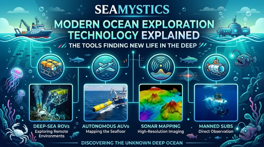

Modern ocean exploration technology explained in one line: it is a mix of robots, sound waves, cameras and smart software that lets us work where people cannot survive. Picture a robot 3,000 meters down, sending live video to a ship while it lifts a glass sponge with a soft claw. That scene is normal work now, and it adds to what we know about our planet every year. I write about this field for Sea Mystics, and I still feel a small thrill when a new dive feed goes live.
TL;DR: Ocean explorers now use tethered robots (ROVs), free-swimming robots (AUVs), sonar, AI and water DNA tests to map and study the deep. In 2026, researchers have mapped 28.7% of the seafloor, and a single Ocean Census year produced 1,121 new species. The tools work best together, and most of the ocean is still unseen.
| Key takeaway | What it means for you |
|---|---|
| ROVs and AUVs do different jobs | ROVs give live control. AUVs cover more ground alone. |
| Sonar draws the seafloor | Sound works in the dark, so it maps where light cannot reach. |
| AI now watches the video | Software can spot and follow animals in real time. |
| eDNA reads clues in seawater | One water sample can show who lives nearby without a net. |
| 28.7% of the seafloor is mapped | About 71% still has no modern map. |
| Cheaper tools are spreading | More countries and small teams can now explore the deep. |
Modern Ocean Exploration Technology Explained: The Big Picture
Think of it as three jobs. First, tools find where to look. Next, tools go down and see or sample what is there. Finally, tools turn that raw data into knowledge that anyone can use.
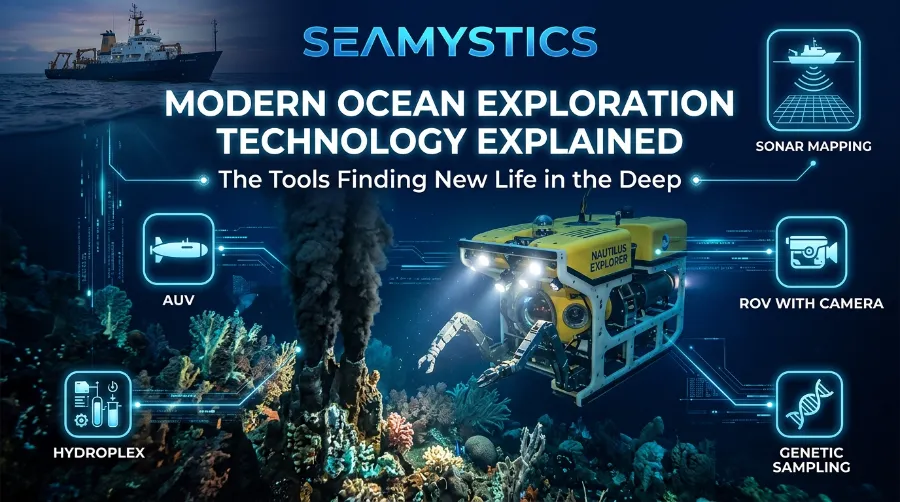
Modern ocean tech does not replace scientists. Instead, it extends our eyes, hands and ears into water that would crush a human body. So the real question is never “robot or human?” It is “which tool fits this question?”
A typical deep dive follows a clear order:
- Scientists study a map and pick a target, such as a seamount or a cold seep.
- A ship carries the robots to the site and lowers them into the water.
- Sonar checks the terrain while the robot descends.
- Cameras and lights record what lives on the bottom.
- Arms, suction samplers or water bottles collect samples.
- The team brings the robot back, then studies the samples on board or in a lab.
In short, the process looks simple on paper. However, each step needs special gear that survives pressure, cold and salt.
NOAA Ocean Exploration: What the Agency Actually Discovers Each Year
Why the Deep Ocean Is So Hard to Explore
The deep sea fights back in five ways. NOAA’s technology explainer lists pressure, cold, darkness, corrosion and slow communication as the main problems for underwater robots. Each problem shapes how engineers build every tool.
- Pressure: Water weight grows with depth, so housings need thick, strong walls.
- Cold: Batteries and electronics lose power in near-freezing water.
- Darkness: Sunlight fades fast, so robots carry their own lights and sonar.
- Corrosion: Salt water eats metal, so parts need special coatings.
- Slow communication: Radio does not travel far in water, and sound is too slow for video.
That last point matters most for understanding robots. Acoustic signals reach up to about one kilometer, but they are still too slow to send video, so AUVs follow pre-programmed plans. Because of this limit, engineers use a cable for live video and a computer brain for free swimming. noaa
Ocean Exploration Tools: ROVs, AUVs and Hybrids
Ocean exploration tools fall into three main groups. Each group has a clear strength. Also, each has a clear weakness.
ROVs: The Tethered Workhorses
ROVs are tethered robots that let researchers make observations, collect samples and run experiments from the surface, and they can stay down for a day or more. A pilot on the ship sees what the robot sees and moves it in real time. As a result, ROVs suit delicate work like picking up a coral branch. whoi
WHOI’s famous ROV Jason shows how long this tool has served science. According to WHOI, Jason has finished thousands of deep-sea missions in the Atlantic, Indian and Pacific Oceans. Now, WHOI is building smaller vehicles to follow it. Each of these mROVs costs more than $5.5 million and should reach sea trials in 2026, with a first full science year in 2027. whoiwhoi
Satellite Ocean Mapping: How Space Technology Studies the Sea
AUVs: Robots That Swim Alone
An AUV has no cable. It follows a preset mission, records data and comes home. For example, the University of Delaware team used the AUV Sentry to hunt for methane seeps on the Mid-Atlantic shelf edge. Sentry is about the size of a motorcycle and runs its mission on its own. udel
AUVs shine when you need large, even coverage. On the other hand, you cannot steer them live or ask them to grab something new. So scientists often send an AUV first to map, then an ROV to sample the best spots.
Ocean Exploration Trust: Inside Modern Deep-Sea Research Missions
Hybrid Vehicles: The Best of Both
Hybrid vehicles try to solve that problem. An HROV can swim free like an AUV to map a wide area, then work as a tethered ROV on a target. In 2026, NOAA also backs a Lake Michigan project that uses a hybrid AUV/ROV with acoustic, imaging and laser sensors to record deep shipwrecks. That work shows hybrids are moving from tests into real fieldwork. whoi
| Feature | ROV | AUV | Hybrid |
|---|---|---|---|
| Cable to ship | Yes | No | Sometimes |
| Live control | Yes | No | Yes, in ROV mode |
| Best job | Sampling, close study | Wide mapping | Map first, then study |
| Weak point | Cable limits range | Cannot change plans mid-mission | Complex and costly |
| Example | Jason, Hercules | Sentry | WHOI mROV plans |
Cost and crew size also change fast. OceanX describes a robotic fleet that pairs an ROV with an uncrewed surface vessel. Meanwhile, DeepOcean added an electric work class ROV in 2025 that works down to 1,500 meters and runs from shore on the uncrewed vessel Challenger. Industry drives many of these gains, and science borrows them soon after. deepoceangroup
Sonar and Mapping: How Scientists Draw the Seafloor
Light dies fast in the sea, but sound travels well. So sonar became the main way to see the seabed. Multibeam, side scan and 3D imaging sonar each give a different view, and low frequencies reach farther while high frequencies show finer detail. deeptrekker
| Sonar type | What it does | Best use |
|---|---|---|
| Single-beam echosounder | Measures the distance to the bottom | Safe piloting, altitude checks |
| Multibeam | Sends many beams in a fan | Detailed depth maps |
| Side scan | Images a strip of seafloor | Searching large areas, wrecks |
| 3D imaging sonar | Builds live point clouds | Close inspection in murky water |
Now for the big number. The Nippon Foundation-GEBCO Seabed 2030 team said in April 2026 that 28.7% of the ocean floor is now mapped, with almost five million square kilometers added in one year. About 220 organizations now contribute, and 15 joined in the past year. You can read the full update on the Seabed 2030 site. seabed2030hydro-international
Here is my compiled timeline from the project’s own yearly releases.
| Year | Share mapped | Change from earlier point |
|---|---|---|
| 2017 | 6% | Project starts |
| 2019 | 15% | Plus 9 points |
| 2022 | About 20% | Plus 5 points |
| 2023 | 24.9% | Plus about 5 points |
| 2024 | 26.1% | Plus 1.2 points |
| 2025 | 27.3% | Plus 1.2 points |
| 2026 | 28.7% | Plus 1.4 points |
The pattern tells a story. Early jumps came from folding in old data. Recent gains are smaller because the easy data is already in. To hit the 2030 goal, the yearly pace must rise a lot, and Seabed 2030 leaders say the same.
From a biologist’s view, a map is not a luxury. First, maps show us where seamounts, canyons and trenches sit. Then, those features guide where we hunt for coral gardens and rare animals. Without a map, an expedition is close to guessing.
Deep Sea Tech Innovations: AI, eDNA and Sharper Cameras
Robots and sonar are the base. Yet the fastest change now comes from software and biology tools. Here are the three deep sea tech innovations I watch most.
Deployable AI That Follows Animals
Video is the biggest data pile in ocean science. One dive can make hours of footage, and people cannot watch all of it. So teams at MBARI and partners built a system that watches for us. Detector and supervisor algorithms review live video for animals they trained on, such as fish, jellyfish, siphonophores and comb jellies. astrobiology
The team tested it on a small ROV first, then in the open water of Monterey Bay in October 2024. Now, NOAA’s 2026 field list shows the project training its AI on FathomNet, a public image set, so the tool keeps learning. Consequently, an AUV may soon spot a new animal and choose to follow it, with no human at the joystick.
Autonomous Underwater Vehicles: How AUVs Are Mapping the Deep
eDNA: Reading Clues in Seawater
Every animal sheds tiny bits of DNA into the water. Scientists filter a water sample, read the DNA and learn who passed by. OceanX’s April 2026 article on eDNA says the method is not a cure-all, but it gives continuous biodiversity data from seawater even in remote places.
That honest tone matters. In my view, eDNA is a superb finder and a weak proof. It can tell you a species is likely near, yet you still need a camera image or a specimen to describe something new.
Lights, Lasers and Wireless Seafloor Tools
Cameras improved, and so did lighting. Laser line scanners now build 3D pictures of wrecks and reefs. Also, seafloor stations can talk without cables. A good example is the ABISS lander, tested on E/V Nautilus in July and August 2017, which I cover in the case studies below.
Deep Sea Cables: The Hidden Infrastructure Beneath the Ocean
New Ocean Technology 2026: What Changed This Year
New ocean technology 2026 is less about one shiny machine and more about many steady gains. Here is what stands out this year:
- Mapping: Seabed 2030 reached 28.7%, its best yearly gain so far.
- Vehicles: WHOI’s mROVs approach sea trials, and hybrid vehicles work on real projects.
- Live streaming: NOAA reports that Nautilus will map the Mariana Islands area and stream ROV Hercules video to the public.
- AI: Deployable AI moves from tank tests toward routine dives.
- Discovery: Ocean Census reported 1,121 new species in a single year.
Those species numbers deserve a closer look. Here is a table of recent results I gathered from published reports.
| Report | Date | Result | Depth or place |
|---|---|---|---|
| Ocean Census annual release | May 2026 | 1,121 new species, a 54% jump in yearly identification | Down to 6,575 m |
| Christmas and Cocos seamounts study | Published June 2026 | 149 new species | Indian Ocean seamounts |
| Japan mission with JAMSTEC | June 2025 dive, confirmed April 2026 | 38 new species from 528 specimens | Nankai Trough, Shichiyo Seamounts |
| Schmidt Ocean Institute midwater trip | 2026 report | 31 new species in two weeks | Off Brazil |
| Natural History Museum amphipod work | March 2026 | 24 new crustacean species | Pacific deep sea |
Sources for each row are listed in the References section.
Real Case Studies From the Field
Numbers help, but stories show how the tools work together. These three cases come from published expedition reports.
Case 1: A wireless lab on the seafloor (2017). From July 31 to August 4, 2017, E/V Nautilus tested the ABISS lander off California. The Nautilus team explains that Harvard’s Dr. Pete Girguis led the project, which pairs a lander with a camera, LED lights and a laser-based link to study microbes and chemistry. The team also revisited methane seeps that ROV Hercules had found near Point Dume in 2015 and 2016. The lesson is clear. A robot finds the site, and a lander stays to watch it over time. nautiluslive
Case 2: Sub, ship and taxonomists in Japan (2025 to 2026). The June 2025 mission used the research vessel Yokosuka and the manned submersible Shinkai 6500, collected over 528 specimens and confirmed 38 new species. Notice the time gap. The dive took days, but the naming work took months, because experts had to compare DNA and body shape. That is why discovery counts trail behind dive dates. prnewswire
Case 3: Two weeks off Brazil (2026). A midwater team on Schmidt Ocean Institute’s Falkor (too) found over 30 new species using advanced technology in the space between the sunlit layer and the seafloor. Midwater is Earth’s largest living space, and it gets far less study than the seabed. So I expect more headlines from this zone soon. bigelow
Modern Ocean Tech Is Getting Cheaper and More Open
Big ships cost a fortune. As a result, many coastal nations and small labs cannot join deep work. Low-cost tools try to fix that.
The Ocean Discovery League writes often about this shift. Its blog covers workshops and low-cost gear such as the Maka Niu system, and its site lists 2026 training workshops in Hawaii and in Trinidad and Tobago. In addition, OceanX runs young explorer programs that put students on real research ships.
Why does this matter for science? More teams in more places means more data from more regions. Also, local experts know their own waters best. Therefore, a cheap camera in the right hands can beat an expensive robot in the wrong place.
Here is where Sea Mystics readers can go next. Start with our guide to how ROVs find new deep sea species for the animal side of this story. Then read about Sylvia Earle and the rise of deep diving to see how human explorers paved the way. Finally, check our report on ghost nets in the deep ocean to see how these same tools now find lost fishing gear.
Alvin Research Submersible and Nautile: Famous Research Submarines Explained
Limits, Risks and My Honest Take
I love this field, yet I want to be direct about its limits. Better tools do not fix everything.
First, a map is not understanding. Knowing that a seamount exists tells you little about how its animals live. Second, sampling is uneven. Most dives happen near rich countries and easy ports, so our picture of the deep leans toward those areas.
Third, data sharing decides the value of the tech. A robot that films a rare fish helps nobody if the footage sits on a private drive. For this reason, I trust projects that publish open data, like Seabed 2030 and FathomNet, more than closed ones.
Finally, new tools bring pressure to use the deep for profit. Better access can help protection or help extraction. So I always ask one question when I read tech news: who will use this data, and for what?
Here is a quick checklist I use to judge any ocean tech claim:
- Does the article name the vehicle or instrument?
- Does it give a date, depth and place?
- Does it link to the lead institution or a peer-reviewed paper?
- Does it separate “possible new species” from “confirmed new species”?
- Does it say what the tool cannot do?
Quick Answers to Common Questions
What is the difference between an ROV and an AUV?
An ROV connects to a ship by a cable and a pilot steers it live. An AUV swims alone on a preset plan. ROVs suit close work, and AUVs suit wide surveys.
How much of the ocean floor has scientists mapped?
As of April 2026, Seabed 2030 reports 28.7% mapped to modern standards. That leaves about 71% without a modern map.
How do scientists find new deep sea species?
They use ROVs, submersibles and nets to collect animals, then compare body shape and DNA. Ocean Census reported 1,121 new species in one year, though experts need months to confirm each one.
What is eDNA and why does it matter?
eDNA is DNA that animals shed into water. Scientists filter seawater and read the DNA to see which species live nearby, without catching them.
Can AI really identify deep sea animals?
Yes, in a limited way. Systems trained on image sets like FathomNet can detect and track animals such as jellyfish and comb jellies in live video. Still, experts must check unusual finds.
Conclusion
Modern ocean exploration technology explained simply comes down to teamwork between tools. Sonar draws the map, robots visit the best spots, AI and eDNA read the clues, and taxonomists name what we find. In 2026, we know more than ever, yet roughly 71% of the seafloor still lacks a modern map.
The next big steps are clear: faster mapping, smarter vehicles, open data and lower costs. If you care about the deep, follow the sources below, share what you learn and support open ocean science. Then come back to Sea Mystics for the next dive.
Test Your Knowledge: 5 Question Quiz
1. Which robot is connected to a ship by a cable?
A) AUV B) ROV C) Glider
2. What share of the ocean floor did Seabed 2030 report as mapped in 2026?
A) 12.4% B) 28.7% C) 51.9%
3. What does eDNA help scientists do?
A) Cool ocean robots B) Detect species from water samples C) Make sonar louder
4. True or false: Sound travels farther than light in deep water, so sonar is a key mapping tool.
5. True or false: eDNA alone can prove a new species exists.
Answers: 1) B. 2) B. 3) B. 4) True. 5) False, because you still need images or a specimen.
References
- NOAA Ocean Exploration. Ocean Exploration Technology: How Robots Are Uncovering the Mysteries of the Deep. https://oceanexplorer.noaa.gov/explainers/technology/
- NOAA Ocean Exploration. Ocean Exploration in the Field: 2026. https://oceanexplorer.noaa.gov/expedition-2026-expeditions/
- Seabed 2030. Global seabed mapping reaches new milestone, 20 April 2026. https://seabed2030.org/2026/04/20/global-seabed-mapping-reaches-new-milestone-as-five-million-square-kilometres-added-in-a-year/
- Hydro International. Record-breaking five million square kilometres of seabed mapped last year, 21 April 2026. https://www.hydro-international.com/content/news/global-seabed-mapping-sets-new-record-with-five-million-square-kilometres-added-in-a-year
- Hydro International. Seabed 2030’s invaluable journey. https://www.hydro-international.com/content/article/seabed-2030-s-invaluable-journey
- Eos. New Seafloor Map Only 25% Done, with 6 Years to Go. https://eos.org/articles/new-seafloor-map-only-25-done-with-6-years-to-go
- Seabed 2030. World Hydrography Day update, 21 June 2025. https://seabed2030.org/2025/06/21/seabed-2030-announces-millions-of-square-kilometers-of-new-seafloor-data-on-world-hydrography-day/
- Woods Hole Oceanographic Institution. New underwater vehicles in development at WHOI. https://www.whoi.edu/oceanus/feature/new-underwater-vehicles-in-development-at-whoi/
- Woods Hole Oceanographic Institution. Underwater vehicles. https://www.whoi.edu/ocean-learning-hub/ocean-topics/ocean-tech/underwater-vehicles/
- University of Delaware. Deep sea exploration. https://www.udel.edu/udaily/2026/march/deep-sea-exploration-marine-robotics-underwater-vehicles-robots-autonomous-vehicles/
- DeepOcean. DeepOcean strengthens subsea robotics asset base, 18 June 2025. https://www.deepoceangroup.com/articles/deepocean-strengthens-subsea-robotics-asset-base
- Deep Trekker. Underwater Sonar Systems Guide (2026). https://www.deeptrekker.com/news/sonar-systems
- Astrobiology.com. Deployable Artificial Intelligence for Exploration and Discovery in the Deep Sea. https://astrobiology.com/2026/02/18/deployable-artificial-intelligence-for-exploration-and-discovery-in-the-deep-sea/
- OceanX. The Ocean Leaves Clues: How eDNA is Revolutionizing Marine Science, 17 April 2026. https://oceanx.org/blog/the-ocean-leaves-clues-how-environmental-dna-is-revolutionizing-marine-science/
- OceanX. Autonomous Allies: The ROV and USV. https://oceanx.org/blog/autonomous-allies-the-rov-and-usv/
- OceanX. The Water Column blog. https://oceanx.org/blog/
- Ocean Exploration Trust. From Inner Space to Outer Space: Developing Technologies for Exploring Oceans, 2017. https://nautiluslive.org/blog/2017/07/30/inner-space-outer-space-developing-technologies-exploring-oceans
- Ocean Discovery League. Ocean Discovery Blog. https://www.oceandiscoveryleague.org/blog
- Ocean Census and Ocean Decade. Scientists discover over 1,100 new marine species in landmark Ocean Census, May 2026. https://oceandecade.org/news/partner-news/scientists-discover-over-1100-new-marine-species-in-landmark-ocean-census/
- Nippon Foundation and JAMSTEC. Japan deep-sea expedition results, 1 April 2026. https://tools.prnewswire.com/en-us/live/20823/release/20260401EN22498
- Mongabay. Scientists discover 149 new deep-sea species at remote Indian Ocean seamounts, August 2026. https://news.mongabay.com/2026/08/scientists-discover-149-new-deep-sea-species-at-remote-indian-ocean-seamounts/
- Bigelow Laboratory for Ocean Sciences. 31 New Species Discovered in Two Weeks of Deep-Sea Exploration. https://www.bigelow.org/news/articles/2026-06-08.html
- Natural History Museum. Dozens of deep-sea species discovered as new crustaceans named, 30 March 2026. https://www.nhm.ac.uk/discover/news/2026/march/dozens-deep-sea-species-discovered-new-crustaceans-named.html