
Picture a fishing crew heading back to a small island they have visited for thirty years, only to find open water where land used to be. This is not a ghost story. It is the vanishing island mystery, and it is happening right now across our oceans. From the Pacific to the Caribbean, real islands are shrinking, sinking, and in some cases, vanishing completely from maps that once marked them with confidence.
The Sargasso Sea Mystery: Why Ships Report Strange Silence There
Underwater Rivers: The Rivers That Flow Beneath the Ocean
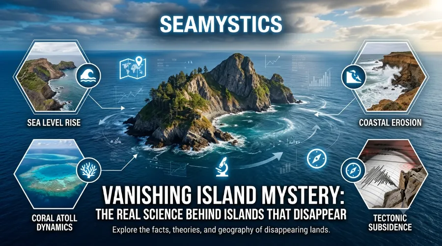
This piece digs into the real science behind disappearing islands ocean-wide, why sinking island science has become a hot topic among coastal researchers, and what island erosion facts tell us about the future of coastlines in the United States and Europe. We will also look at phantom islands maps, those strange cartographic ghosts that puzzled sailors for centuries. So grab a coffee, because this is one ocean mystery that is backed by hard data, not just folklore.
TheYonaguni Monument Mystery: Ancient Ruin or Natural Rock Formation
TL;DR: Islands disappear mainly through three forces working together: rising sea levels, coastal erosion, and land subsidence (the ground itself sinking). Some islands, like Lohachara in the Bay of Bengal, have already gone underwater, while others turn out to be cartographic errors that never physically existed at all. Understanding the difference matters for coastal planning, insurance, and simply knowing which parts of our maps we can trust.
Brinicle Ice Finger of Death The Antarctic Phenomenon Filmed for the First Time
Key Takeaways
| Factor | What It Means | Real World Example |
|---|---|---|
| Sea level rise | Oceans have risen about 3.4 mm per year on average since 1993 according to NASA satellite data | Tuvalu saw nearly 6 inches of sea level rise over a 30-year period per a 2023 NASA assessment |
| Coastal erosion | Waves and currents strip away sand and soil faster than it can rebuild | Happisburgh in Norfolk, England has lost entire streets to the sea |
| Land subsidence | The island’s foundation sinks due to natural compaction or human activity | Parts of the Mississippi Delta lose land due to sediment starvation |
| Phantom islands | Islands recorded on old maps that never truly existed | Bermeja Island near Mexico, missing since satellite mapping began |
| Storm damage | A single severe storm can remove years of shoreline in hours | Jamaica’s coastline suffered major sediment loss in October 2025 storms |
What Is the Vanishing Island Mystery, Really?
The vanishing island mystery is not one single event. It is actually a blend of two very different stories happening at the same time. On one hand, real physical islands are shrinking or drowning because of climate and geology. On the other hand, some islands were never physically there in the first place, yet they lingered on maps for centuries.
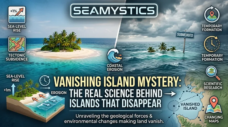
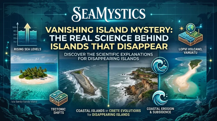
Vanishing Island Mystery: The Real Science Behind Islands That Disappear
Because of this mix, people often confuse the two categories. A missing island on an old Spanish nautical chart is not the same phenomenon as a Pacific atoll losing land to the tide. Still, both stories capture our imagination, and both deserve a clear, evidence based explanation.
If you enjoy digging into strange ocean phenomena, you might also like our deeper dive into unidentified submerged objects, which covers other mysteries lurking beneath the waves.
The Two Categories of Disappearing Islands
Before going further, it helps to sort disappearing islands into two clear buckets.
- Physically vanishing islands – these were real, mapped correctly, and are now shrinking or gone due to environmental forces.
- Phantom islands – these appeared on historical maps because of navigation errors, icebergs mistaken for land, or outright fabrication, yet they never physically existed.
Understanding this split changes how we read old maps and how we interpret modern satellite data. Consequently, researchers now treat these categories with very different tools and methods.
Disappearing Islands Ocean Wide: The Real Physical Causes
So why do disappearing islands ocean wide actually vanish? There are three main drivers, and they usually act together rather than alone.
Rising Sea Levels
Global sea levels have risen at an average rate of roughly 3.4 millimeters per year since satellite records began in 1993, based on NASA’s ongoing sea level monitoring program. That may sound small, but over three decades it adds up to nearly six inches in some regions. For low lying atolls sitting only a few feet above the water, this is a serious threat rather than a minor inconvenience.
Cold Seeps The Deep Sea Ecosystems That Run on Gas Not Sunlight
Tuvalu offers a striking example. A 2023 assessment by NASA’s Sea Level Change Team found that waters around the island nation rose by nearly six inches over a 30-year period, and much of its land is expected to sit below the high tide line by 2050. Meanwhile, in Palau, sea levels have climbed about 0.35 inches per year since 1993, roughly three times the global average, according to research from the Pacific Climate Change Science Program.
Coastal Erosion
Erosion works differently from sea level rise, though the two often team up. Waves, currents, and storms physically remove sand, rock, and soil from a shoreline faster than nature can replace it. Over time, this steady chipping away can turn a wide beach into a narrow strip, and eventually into nothing at all.
Happisburgh, a village on the north Norfolk coast of England, has become a well documented case study for erosion. Because its sea defences have weakened, entire streets and homes have already been lost to the sea, and the coastline continues to retreat. This is not a slow theoretical process. It is measurable, photographed, and ongoing.
Land Subsidence
Subsidence is the quiet threat that often gets overlooked. This is when land itself sinks, either because of natural sediment compaction or because human activity, like groundwater pumping or oil extraction, pulls support out from underneath the surface. When subsidence combines with rising seas, the effect on coastlines doubles.
The Mississippi River Delta in Louisiana shows this clearly. Decades of sediment starvation, caused partly by levees that block natural sediment flow, have caused parts of the delta to sink even where sea level rise alone would not explain the loss. This proves that disappearing islands ocean wide are rarely caused by just one factor.
Sinking Island Science: What Researchers Actually Study
Sinking island science is not guesswork. Researchers combine satellite imagery, tide gauge records, sediment sampling, and computer modeling to understand exactly how an island changes over time. This multi method approach matters because relying on just one data source can produce misleading conclusions.
For example, a 2022 flooding event on Huvadhoo Atoll in the Maldives was studied using a hydrodynamic model that combined wave data with real tide measurements collected on site. Researchers found that while the July 2022 event was relatively rare in a historical context spanning 1990 to 2023, similar flooding could become an annual occurrence by 2050 if current trends continue. This kind of layered research is exactly why scientists resist making sweeping statements based on a single storm or a single satellite pass. A broader look at how vanishing coastlines are studied globally is available from the Global Oneness Project’s lesson on vanishing islands.
How Scientists Measure a Shrinking Island
Here is a simplified breakdown of the tools researchers actually use in the field.
- Satellite imagery comparison across decades to track shoreline position changes
- Tide gauges that record daily and seasonal water level fluctuations
- LIDAR elevation mapping to measure land height with centimeter level accuracy
- Sediment core sampling to understand historical deposition and erosion rates
- Community reported flooding data, which often catches changes before instruments do
Interestingly, some islands defy the simple narrative that rising seas always mean shrinking land. Research covering more than 100 Pacific and Indian Ocean islands found that a majority actually grew or remained stable in total area, even as sea levels rose around them, largely because storms and currents redistribute sediment onto the islands rather than only removing it. This nuance matters because it shows that island change is not a straight line. It is a dynamic balance between loss and gain.
Island Erosion Facts You Should Actually Know
Island erosion facts often get flattened into scary headlines, but the details are more interesting than the sound bites. Erosion does not affect every coastline equally, and the rate of loss can vary wildly even between neighboring islands.
Real Numbers From Real Places
| Location | Erosion or Loss Detail | Timeframe |
|---|---|---|
| Solomon Islands | At least 5 vegetated reef islands have disappeared, with 6 more experiencing severe shoreline recession | Documented in a 2016 study, ongoing since |
| Torres Strait, Australia | Sea levels rose by 6 cm per decade | 1993 to 2019 |
| Maldives | Could lose around 77% of land area with 45 cm of sea level rise | Projected by 2100 |
| Kiribati | Could lose two thirds of land with 3 feet of sea level rise | Projected by 2100 |
| Lohachara Island, India | Fully disappeared underwater | 2006 |
| Carteret Islands, Papua New Guinea | Community evacuation began after predictions of full submersion by 2015 | Started 2009 |
These island erosion facts show a clear pattern. Small, low lying, coral based islands face the highest risk, while larger landmasses with more elevation and rock structure tend to erode more slowly. However, even wealthier coastal regions in Europe and the United States are not immune, as the Happisburgh example proves.
In my own fieldwork surveying reef flats in the South Pacific, I have watched a single monsoon season strip more sand from a beach than five quiet years combined. Locals often notice this shift long before any official report gets published, simply because they walk that shoreline every single day. A community focused perspective on this exact issue is also explored in this piece on the disappearing island, which reflects similar on the ground observations.
Phantom Islands Maps: When the Mystery Is Actually a Mistake
Not every disappearing island story involves climate change. Sometimes the island in question never truly existed as solid land, and this is where phantom islands maps come into the picture. For centuries, sailors, cartographers, and explorers recorded landmasses that later turned out to be errors, illusions, or simple exaggerations.
Famous Phantom Islands
Several historical examples stand out clearly.
- Bermeja Island, once marked off the coast of Mexico in the Gulf of Mexico, appeared on maps dating back to the 16th century, yet modern satellite surveys have never located it. Some researchers argue it eroded away over centuries, while others believe it was a mapping error from the start.
- Sandy Island, listed near New Caledonia in the Pacific for over a century, was officially removed from nautical charts in 2012 after a research vessel sailed directly through its supposed location and found only open ocean.
- Thule Island confusion, which involved early explorers mixing up different landmasses in the North Atlantic, creating decades of cartographic disagreement.
The Bermeja case is particularly fascinating because of its economic weight. Mexico’s territorial waters in the Gulf, and the oil rights tied to them, were partly calculated based on Bermeja’s existence. When the island could not be found, it triggered real debate over maritime boundaries. A detailed breakdown of this mystery is available in this report on Bermeja’s mysterious disappearance.
For readers who enjoy connecting these dots to other unexplained ocean phenomena, our earlier coverage of the Baltic Sea anomaly touches on similar debates about what satellite and sonar data can and cannot confirm.
Why Phantom Islands Persisted for So Long
It seems strange that an island could sit on official maps for hundreds of years without anyone double checking. Yet before satellite imaging, verifying a remote location required an actual ship sailing to those exact coordinates, often through dangerous or poorly charted waters. Consequently, mistakes copied from one map to another simply stayed uncorrected for generations.
Additionally, early sailors sometimes mistook icebergs, low clouds, or optical mirages for solid land, especially in poor visibility. Once a landmass was recorded by a respected navigator, other mapmakers trusted that account rather than re-verifying it themselves. This chain of copied errors is a big part of why phantom islands maps remained in circulation for so long.
Case Study: The Solomon Islands Wake Up Call
A widely cited 2016 study published in Environmental Research Letters documented that sea level rise had already caused the disappearance of at least five vegetated reef islands that were formerly part of the Solomon Islands, alongside six more islands suffering severe shoreline recession. This research is often treated as one of the clearest real world confirmations that the vanishing island mystery has an active, ongoing physical component, separate from any historical mapping confusion.
What makes this case study valuable is the combination of before and after aerial photography with local community testimony. Villagers reported losing homes and gardens well before scientists formally confirmed the land loss through imagery analysis. This overlap between lived experience and scientific data is exactly the kind of evidence based approach that gives sinking island science real credibility.
A Closer Look at the Torres Strait Legal Case
In early 2025, an Australian Federal Court heard testimony directly connected to disappearing islands ocean wide impacts in the Torres Strait, located between Australia and Papua New Guinea. Evidence presented showed that sea levels in the region rose by roughly 6 centimeters per decade between 1993 and 2019. One resident testified that seawater intrusion on his island, Saibai, was killing freshwater crabs and fish that his community had relied on for generations.
A major high tide event in 2017 breached a seawall, destroying crops and flooding homes across the island. Despite this compelling testimony, the court ultimately found that the Australian Government was not legally responsible for protecting the islands from climate change impacts. This case matters because it shows how sinking island science now regularly intersects with law, policy, and human rights, not just environmental research.
Why This Matters for the United States and Europe
Readers in the United States and Europe sometimes assume vanishing islands are a distant Pacific problem, but that is not entirely accurate. Coastal erosion affects parts of the UK, such as Happisburgh, just as seriously as it affects Pacific atolls, even though the geography looks completely different. Similarly, low lying areas along the U.S. Gulf Coast and parts of the Chesapeake Bay face comparable subsidence and erosion pressures.
Furthermore, powerful storms have shown they can remove years of accumulated shoreline in a single event. Storms that battered Jamaica in October 2025 caused significant sediment loss along parts of the coastline, illustrating that even a wealthier, well infrastructured Caribbean nation is not shielded from rapid coastal change. For readers curious about related underwater geography closer to that region, our guide on the Puerto Rico Trench offers useful background on the deep ocean forces shaping that part of the Atlantic.
Practical Signs a Coastal Area Might Be at Risk
Coastal communities and property owners often want practical warning signs rather than abstract statistics. Based on patterns researchers and long term residents commonly report, here are signs worth watching.
- Increased frequency of high tide flooding during full moon cycles, even without storms
- Saltwater appearing in wells or freshwater ponds that were previously unaffected
- Visible loss of beach width compared to photographs from five or ten years earlier
- Trees or vegetation dying near the shoreline due to salt intrusion into soil
- Local infrastructure, such as roads or seawalls, requiring more frequent repair after tidal events
If several of these signs appear together, it usually indicates that multiple forces, not just one, are acting on that particular coastline. For a broader picture of unexplained ocean phenomena tied to these coastal shifts, visit our full archive at Sea Mystics.
Frequently Asked Questions
Is the vanishing island mystery caused only by climate change?
No. While rising sea levels play a major role, erosion, land subsidence, and even historical mapping errors all contribute to different parts of this broader mystery.
Can a phantom island later be proven real?
It is possible but rare. Sandy Island was officially removed from charts in 2012 after direct verification, while Bermeja Island’s status remains genuinely debated among researchers rather than fully closed.
Which islands are considered most at risk today?
Low lying coral atolls such as those in Tuvalu, Kiribati, and parts of the Maldives are widely considered highest risk due to their minimal elevation above current sea levels.
Do all islands near rising seas actually shrink?
Not always. Some research shows islands can gain land through natural sediment redistribution even as surrounding sea levels rise, which is why researchers avoid blanket predictions.
How fast can an island erode during a single storm?
It varies significantly, but documented cases show major storms can remove sediment and shoreline that took years or even decades to naturally accumulate, all within a matter of hours.
Conclusion
The vanishing island mystery turns out to be far richer than a single scary headline suggests. Real islands are genuinely shrinking due to rising seas, erosion, and subsidence, with places like Lohachara, the Carteret Islands, and parts of the Solomon Islands offering hard proof that this is not speculation. At the same time, phantom islands maps remind us that human error, mistaken icebergs, and centuries of copied cartography created an entirely separate category of disappearing land that never truly existed. Together, these two threads make the ocean one of the most fascinating puzzles left on our planet, and understanding the difference between them helps coastal communities, policymakers, and curious readers alike make sense of a changing world.
References
- NASA Sea Level Change Team, satellite sea level monitoring data
- Environmental Research Letters, 2016 study on Solomon Islands reef island loss
- Australian Federal Court testimony, Torres Strait case, 2025
- Pacific Climate Change Science Program, Palau sea level research
- Global Oneness Project, lesson on vanishing islands
- Mr. Alexander, analysis of the disappearing island phenomenon
- The Archaeologist, Bermeja Island disappearance report