

A diver once told me that the sea keeps its secrets by making them look boring. I think the opposite is true. The sea makes simple things look strange, and sonar is where that illusion begins. When a screen shows a circle, a long streak, or a perfect straight line on the seabed, our eyes jump to the wildest answer first. This guide walks through real cases of sonar unidentified shapes, shows what they turned out to be, and gives you a method to judge the next viral image yourself.
TL;DR: Most sonar unidentified shapes come from natural rock, shipwrecks, lost fishing gear, or software and water effects. A shape is only “unexplained” until someone sends a camera or a second sonar pass to check it. Use the table below for a fast overview.
| Key takeaway | What it means for you |
|---|---|
| Sonar draws sound, not pictures | A shape on screen is an echo map, so it can stretch, shadow, or repeat |
| Rock and glacial deposits fool people most | Natural stone can look round, flat, or built |
| Ghost nets create odd tangled targets | Lost gear can sit as large, rough mounds for years |
| One scan is never enough | Experts confirm with a second angle, a second frequency, or an ROV |
| Good reports show method | Look for depth, frequency, date, and a follow up dive |
What Sonar Really Shows You
Sonar sends out a pulse of sound and listens for the echo. The machine then turns the timing and strength of each echo into colors or shades. That means the image is a guess about shape, not a photo. Hard objects send back strong echoes, while soft mud sends back weak ones.
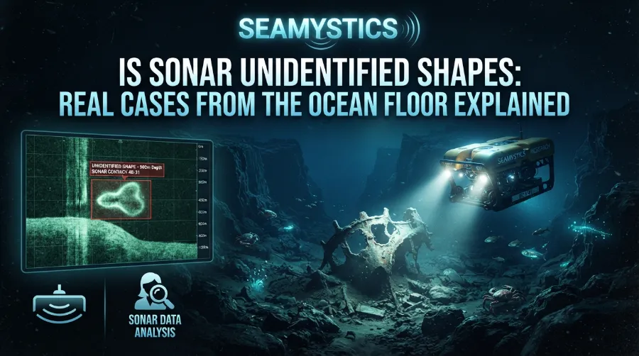
Side scan sonar is a common tool for finding odd targets. It looks sideways from a towed fish and builds a strip image of the seabed. If you want a clear view of where this tech is heading, Ocean News covers how side scan sonar is being used to chart history. Multibeam sonar works differently, because it fans many beams down to measure depth. A good plain guide to that process is the Oceanology International explainer on how multibeam sonar works.
Here is a quick chart of how the two main tools differ. These are typical ranges, and real numbers change by model.
| Tool | Best for | Typical detail | Common trap |
|---|---|---|---|
| Side scan sonar | Finding wrecks, debris, and rock fields | High at short range | Long shadows can look like tall objects |
| Multibeam sonar | Mapping depth and shape of the seafloor | Good for terrain | Noise creates false bumps and ridges |
| Sub bottom profiler | Looking under the seabed surface | Shows buried layers | Can mix layers into a false shape |
Why a Sonar Mystery Object Looks So Real
Humans see patterns fast. We see faces in clouds, and we see ships in rock piles. Sonar adds to that problem because shadows make flat objects look tall and tall objects look like spikes. A scan also changes with the boat’s speed, the tow height, and the angle of the beam.
Rare Abyssal Footage: Deep-Sea Creatures Caught on Camera Only Once
Water adds more trouble. Layers of warm and cold water bend sound, which can shift where an echo seems to come from. Fish schools, bubbles, and mud clouds can also mark the screen with fake targets. Because of this, a single strange sonar reading tells you very little by itself.
Experts often reduce these mistakes with a few steps. This is a simple routine I teach students who review survey logs:
- Check the settings first, including frequency, range, and tow height.
- Look at the shadow and measure it, because it shows real height.
- Scan the target again from a new direction.
- Compare the shape with known wrecks, rocks, and gear on charts.
- Send a camera or ROV when the target still matters.
Real Case One: The Baltic Sea Anomaly
In June 2011, a Swedish salvage crew called Ocean X reported a round object on the Baltic seabed between Sweden and Finland. Press reports described it as about 87 meters wide and sitting at roughly 90 meters deep. The sonar image showed a circle with a long, straight track behind it, and the internet quickly decided it was a spaceship.
Divers and sample tests later told a calmer story. Geologists who looked at the rock said it fits natural stone, such as granite and gneiss, with glacial history in the area. Ice sheets drag, pile, and shape rock in odd ways, so a round mound with a long scrape is not shocking.
The lesson is simple. A striking image does not equal a strange object. The case also shows why follow up samples matter more than the first headline.
The Faceless Fish Rediscovery: Australia’s Strange Deep-Sea Find
Real Case Two: The Plane Shape That Became Rock
In 2024, a private team shared a sonar image that looked like a small plane on the Pacific floor. Many people linked it to the lost flight of Amelia Earhart, and the story spread worldwide in days. The picture had a clear body, what looked like wings, and a sharp outline.
A later return trip to the site was reported to show a natural rock formation instead. This is a classic example of pareidolia, which means seeing meaning in random shapes. Sonar made the problem worse, since the water was very deep and the image detail was limited.
If you want to see how the field handles ocean mapping responsibly, the NOAA Ocean Exploration program publishes expedition notes that show the full workflow. They usually share the method, the depth, and the follow up dive, which is exactly what a trustworthy report needs.
Real Case Three: The Hunt for Flight MH370
Not every seabed search ends in a false alarm. After Malaysia Airlines flight MH370 vanished in March 2014, search teams scanned roughly 120,000 square kilometers of the southern Indian Ocean. The work ran until January 2017 and cost about 200 million Australian dollars in total.
During that search, teams logged many sonar contacts. Most of them proved to be shipwrecks, geological features, or sea floor noise. Even with strong tools, deep water made every contact hard to confirm.
This case matters for one reason. It shows how many unexplained sonar images appear in a big, serious search, and how few turn out to be what people hoped. Each contact needed time, money, and a second look before anyone could close it.
The Nautilus Live Creature That Looked Alien: What It Really Was
Ghost Nets: The Silent Killers Behind Many Odd Targets
Now we reach a cause that gets less attention than it should. Ghost nets are fishing nets and lines that people lost or threw away at sea. They keep catching fish, turtles, and whales long after the owner is gone. They also drift, sink, and snag on reefs and wrecks.
On a sonar screen, a net mass can look like a rough, tangled blob with no clear edge. Large piles may form bumps tall enough to confuse a survey. When nets wrap around a wreck or rock, the combined shape can look like nothing in the catalog.
The scale of the problem is large. A widely cited 2009 report from the UN’s food and environment agencies estimated that around 640,000 tonnes of fishing gear enter the ocean each year, though this number is an estimate and not a precise count. A 2018 study in Scientific Reports also found that fishing nets made up at least 46 percent of the mass of the Great Pacific Garbage Patch. For more on solutions, groups like Ocean Conservancy work on removing lost gear and tracking where it lands.
Here are signs that a sonar target may be a ghost net:
- A messy, uneven texture with no straight edges
- A mound near a reef, wreck, or rocky ridge
- Soft shadows instead of sharp, tall ones
- Thin lines trailing away from the main mass
- A location close to a busy fishing ground
Helpful Tools: When Divers Stay Home and Robots Go In
Once a target looks worth checking, the next step is usually a camera. Remote operated vehicles, or ROVs, carry lights, cameras, and sampling arms down to depths people cannot reach. A sonar image points the way, and the ROV shows what the echo really was.
This is also where many mystery stories change fast. A shape that looked huge might be a small wreck with a long shadow. A glowing spot might be a reflection, a fish, or a lamp effect, as covered in our guide on strange ROV mystery lights. For live deep sea footage where creatures show up unexpectedly, you can also read about the Nautilus live creature sighting.
Mystery Egg Cases on the Ocean Floor: What Lays Them?
Another useful read is a field report on how teams approach unknown targets. The H2O Drones article on using sonar to search for and identify unidentified objects explains practical steps, including repeat passes and target classification. It lines up closely with the routine described above.
How Experts Sort Sonar Unidentified Shapes Into Categories
Survey teams do not start with “alien” or “monster.” They start with a list of normal causes and rule them out one by one. This habit saves time, and it stops teams from chasing false leads.
The table below shows the common categories and the clues that point to each one. It reflects general survey practice, so exact clues differ by site.
| Likely cause | Typical clue on sonar | Best follow up |
|---|---|---|
| Natural rock or glacial deposit | Irregular, rough, and rooted in the seabed | Core sample or ROV pass |
| Shipwreck | Clear hull lines, mast shadow, debris field | Camera dive and history search |
| Ghost net or lost gear | Tangled texture, soft shadow, trailing lines | ROV inspection |
| Pipe, cable, or trench | Long, even line across the bed | Check chart and permit records |
| Sand wave or scour mark | Repeating ripples or bowl shapes | Second scan at a different angle |
| Sonar noise or artifact | Appears once, vanishes on a repeat pass | Recheck settings and reprocess |
Evidence Based Opinions From Survey Practice
After years of reading survey reports, I hold a few firm views. First, the best question to ask is not “What is it?” but “What would prove it wrong?” A claim that cannot be tested is not research. Second, depth and range matter more than most readers think, since faint targets at the edge of a scan are the least reliable.
Unidentified Whale Sounds That Don’t Match Any Known Species
Third, I believe that sharing raw data builds trust faster than any headline. When teams post the frequency, the date, and the processing steps, others can check the work. This is also why open expedition logs earn more trust than a single dramatic screenshot.
Here are practical habits that I recommend to new students:
- Save the raw file before you edit or color the image
- Note the water temperature layers if the survey records them
- Keep a notebook entry for each contact, even the boring ones
- Compare against wreck databases and charts before you share anything
Case Study Style Review: A Typical Survey Day
Picture a coastal survey in cold water, with a small boat towing a side scan unit at slow speed. The crew spots a tall, dark shadow at the edge of the screen and feels the usual spike of excitement. They mark the position and run a second pass from the other direction.
On the new pass, the shadow shrinks and the target flattens into a low, broken mound. A quick check of the chart shows an old fishing ground, and a later dive finds a pile of rope and net wrapped around stone. The final answer was ghost gear on a rock, and the “tall object” was only a shadow trick.
This pattern repeats across many surveys. The first read is dramatic, the second read is calmer, and the third read gives the truth. Patience is the most useful tool on the boat.
The Giant Eyeball Mystery: What Really Washed Up on a Florida Beach
How to Judge the Next Viral Sonar Image
You will see more of these images, since cheap sonar tools are spreading and social media rewards strange pictures. Use a short checklist before you believe or share one.
- Ask who made the image and what tool they used.
- Look for the depth, the date, and the sonar frequency.
- Check whether anyone returned with a camera or ROV.
- Search for an expert opinion from a geologist or marine surveyor.
- Wait for a second source before you share.
This checklist also helps with search engines and AI summaries. Clear, sourced answers tend to get picked up because they state the facts, name the source, and show the date. If you write about the sea, put the core answer first, then add the proof below it. For a wider view of odd underwater sightings, see our hub on unidentified underwater footage, and you can browse more on the Sea Mystics homepage.
Mystery Seafloor Tracks: The Marks No One Can Identify
Frequently Asked Questions
What is a sonar mystery object?
It is a shape on a sonar screen that nobody has identified yet. In most cases, it turns out to be rock, a wreck, or lost gear after a second scan or a camera dive.
Can a strange sonar reading be a mistake in the machine?
Yes. Noise, water layers, boat motion, and wrong settings can all create false targets. A repeat scan usually shows whether the shape is real.
Why do ocean floor sonar anomalies look so geometric?
Sound bends and stretches, and shadows exaggerate height. Natural rock also forms flat faces and round mounds, especially in areas shaped by glaciers.
How do experts confirm an unexplained sonar image?
They scan again from another direction, use a different frequency, and compare with charts. Then they send an ROV or diver to look directly.
Are ghost nets really common on the seafloor?
Yes. Estimates suggest hundreds of thousands of tonnes of fishing gear enter the ocean each year. Nets often snag on reefs and wrecks and create odd shapes on survey screens.
Quick Quiz: Test What You Learned
Question 1. What does a long, dark shadow on a side scan image usually help you measure?
A) Water temperature
B) Object height
C) Boat speed
Question 2. Which of these most often creates a tangled, soft edged target near a reef?
A) A ghost net
B) A glass sphere
C) A sound buoy
Question 3. What happened to the Baltic Sea Anomaly story after samples were studied?
A) It was proven to be a ship
B) Geologists linked it to natural rock
C) It vanished from the seabed
Question 4. True or false: One sonar scan is enough to confirm what an object is.
Question 5. True or false: A second pass from a new angle can help show whether a shape is real.
Answers: 1) B. 2) A. 3) B. 4) False. 5) True.
Conclusion
Sonar unidentified shapes feel magical, but the truth is usually rooted in rock, wrecks, nets, and sound physics. Real cases like the Baltic anomaly, the plane shaped target, and the long MH370 search show the same pattern: a dramatic image first, then a careful answer. When you see the next strange sonar reading, slow down and ask for the method, the second scan, and the camera proof. The mystery is still worth enjoying, and the real answers are often just as interesting.
References
- Ocean News. The Future of Side Scan Sonar to Chart History.
- H2O Drones. Use of Sonar When Searching for and Identification of Unidentified Objects.
- Oceanology International. Mapping the Unknown: How Multibeam Sonar Works.
- NOAA Ocean Exploration. Expedition resources.
- Macfadyen, G., Huntington, T., and Cappell, R. (2009). Abandoned, Lost or Otherwise Discarded Fishing Gear. UNEP and FAO.
- Lebreton, L., et al. (2018). Evidence That the Great Pacific Garbage Patch Is Rapidly Accumulating Plastic. Scientific Reports.
- Australian Transport Safety Bureau. MH370 search reports.